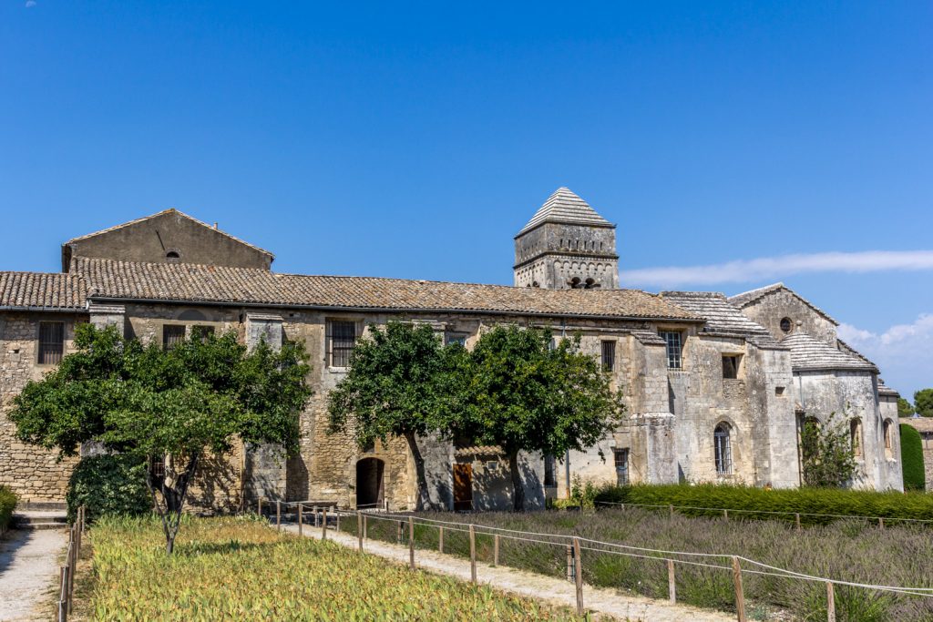
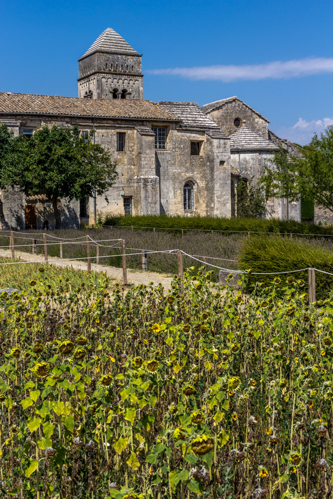
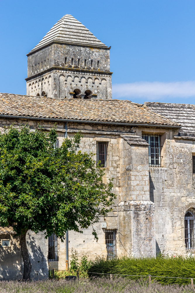
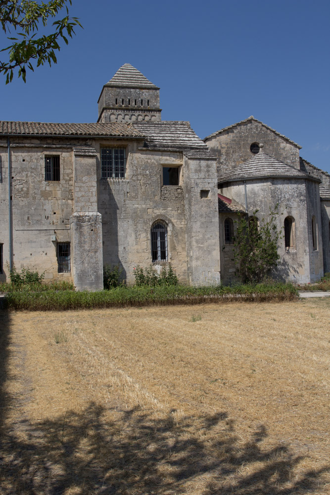
The mental asylum in St Remy de Provence was the place Vincent van Gogh stayed for a year. A Year in which he recovered, suffered, and painted. Very productively. We know of 150 paintings he finished that year.
He entered the asylum on his own free will after the episode with the ear. The clinic offered respite and tranquility. It is located about a mile away from the small town of St Remy. Apparently, Vincent only visited the village once during his stay.
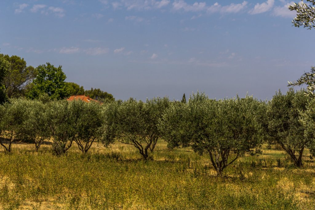
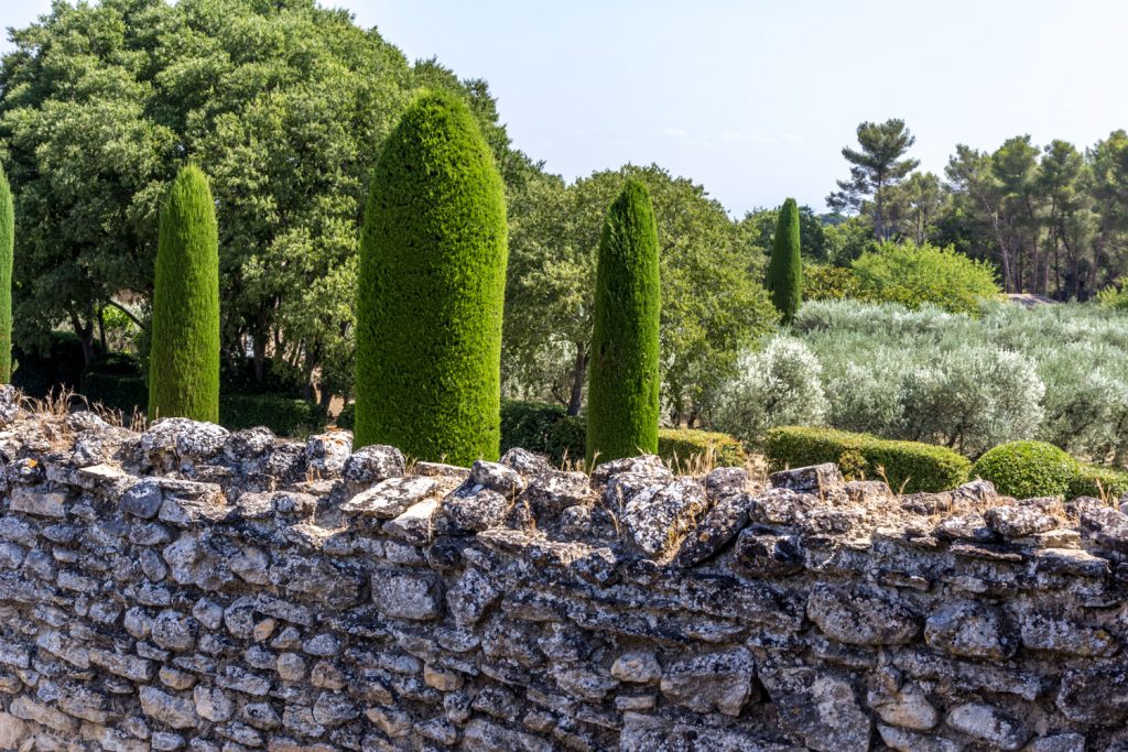
Olive trees in the surrounding nature proved an inspiration for many paintings.
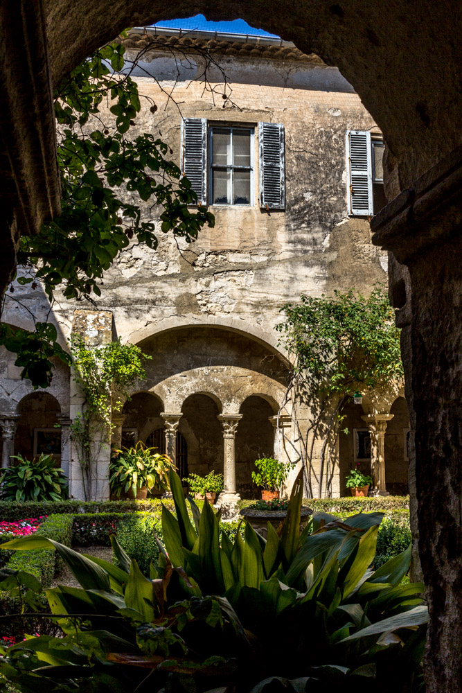
The clinic was not fancy but quite advanced for its time. In the rooms of an earlier monastery, doctors treated patients according to their needs. Vincent was eventually allowed to paint under supervision, and he was given an additional room as a studio.
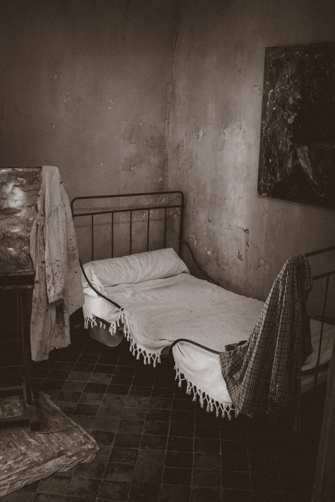
A recreation of the room Vincent van Gogh lived in.
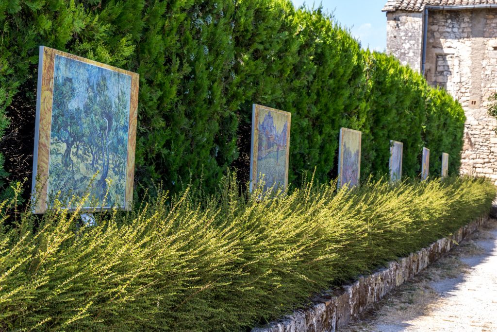
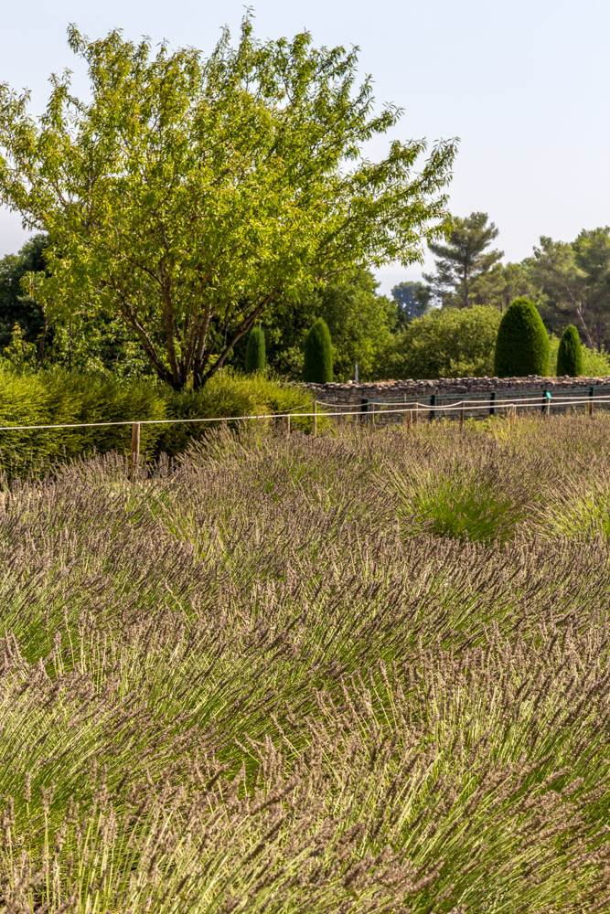
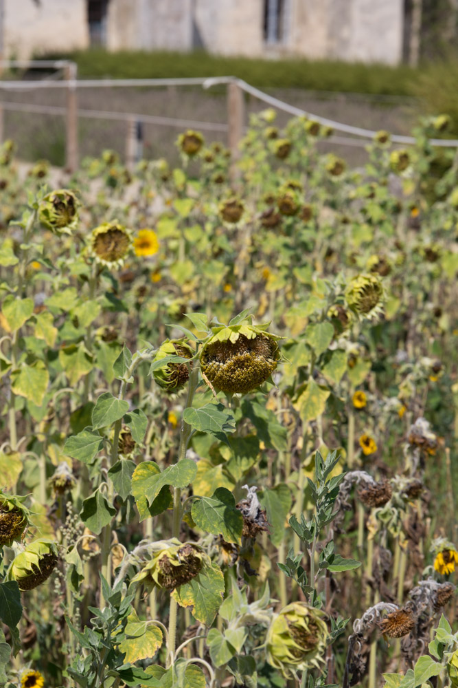
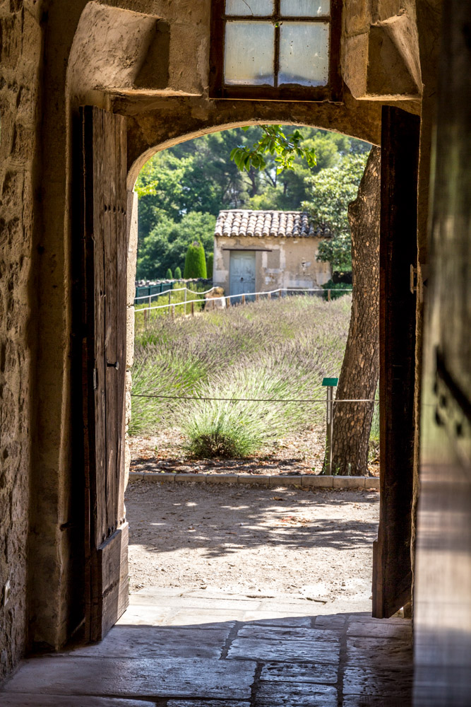
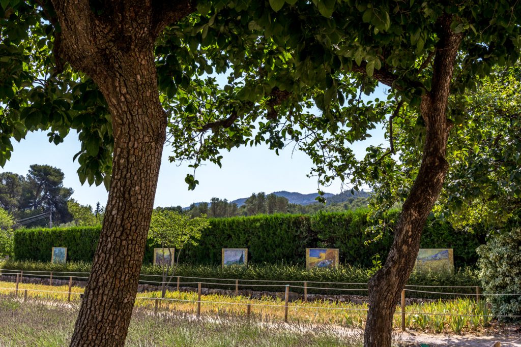
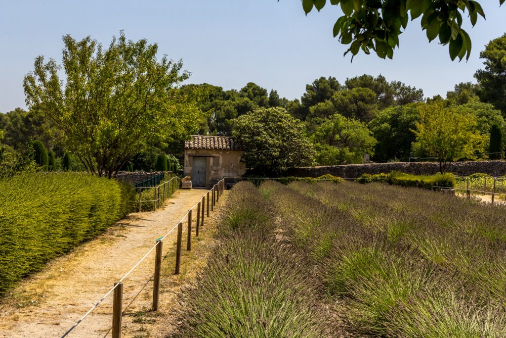
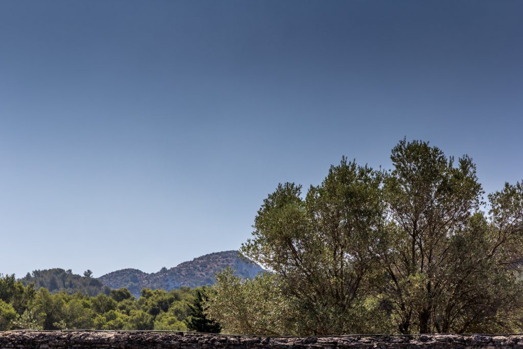
The monastery/clinic is a quiet place. In summer, the cicadas buzz. In the garden, you can see the Alpilles mountain range in the distance. The garden boasts sunflowers, lilies, and even a vineyard. The distressed painter did not move far away from the buildings. There was plenty to take in and depict. Cypress trees along the straight road into town. Today, reproductions allow visitors to see where Vincent planted his easel under the watchful eyes of the supervising attendant.
The reproductions spread throughout the garden and the surrounding area mention all the famous places his paintings are displayed nowadays: New York, Pasadena, Otterlo.
For van Gogh, the stay proved to be very productive. He was away from the distractions of a town. His experience in Arles and the violent encounter with Gauguin had proved to much for his sensible mind. Here, he could become what he wanted to be: focused on painting.
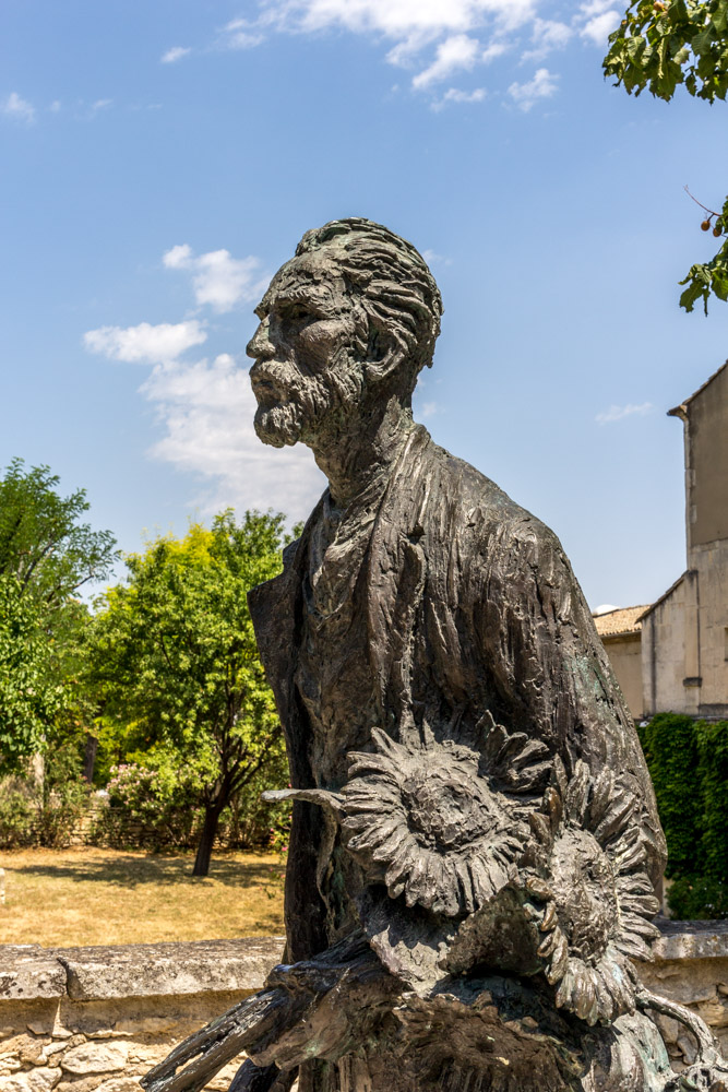
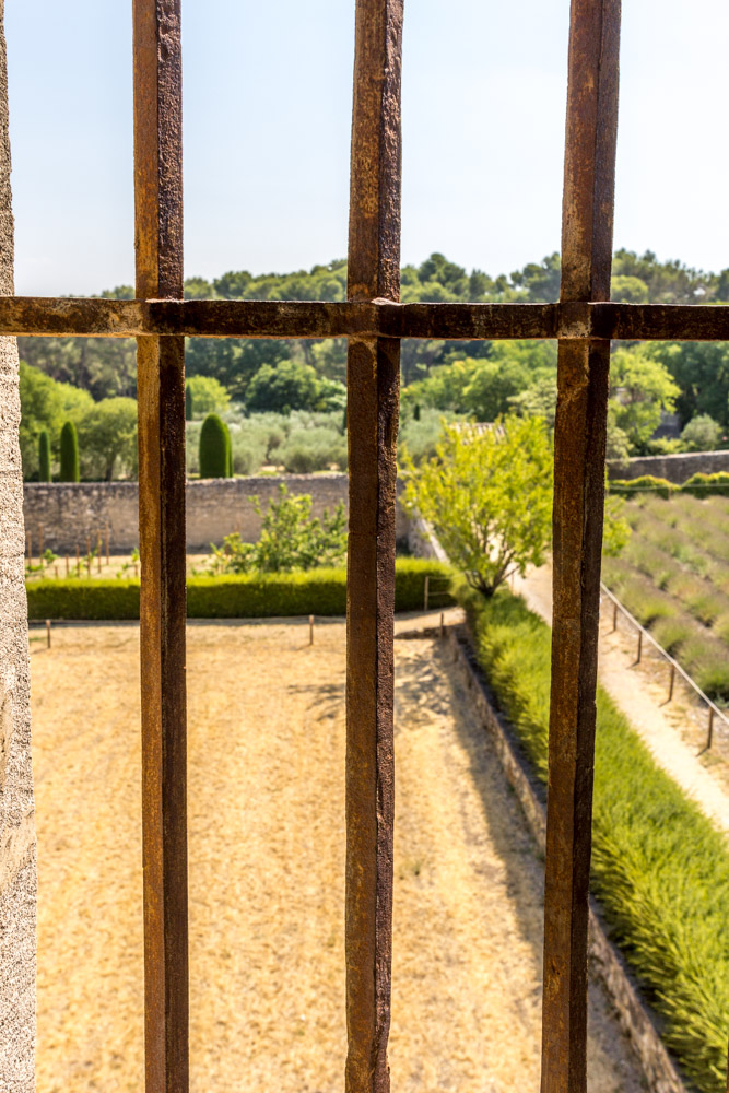
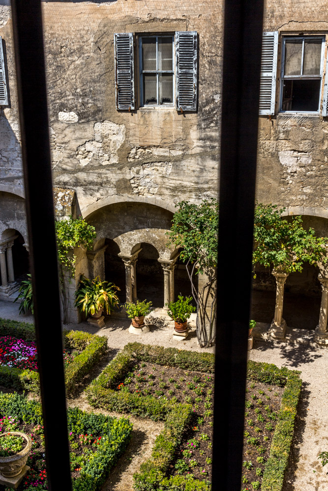
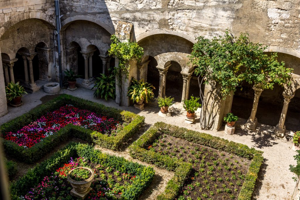
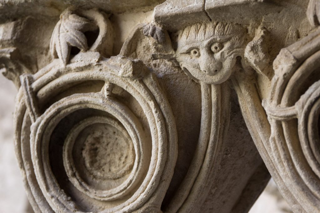
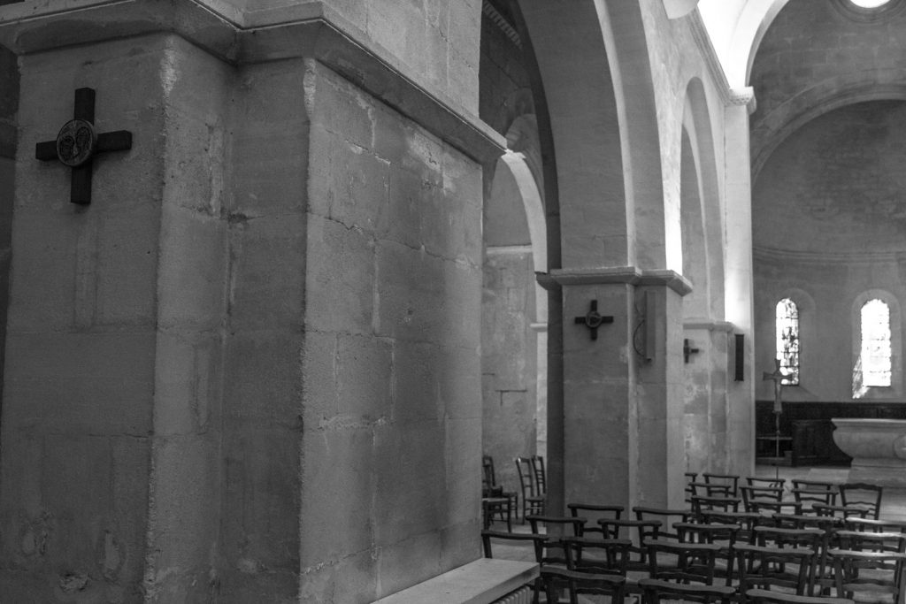
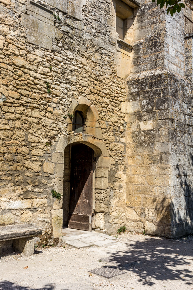
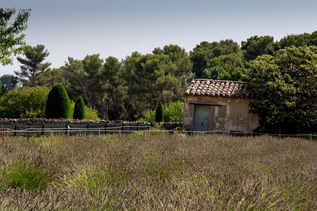
Wilting sunflowers in the July heat. The garden of St Remy.Lavender fields just outside his cell.The statue is titled :The sunflower thief”Iron bars obstruct the view into the garden The interior garden from a cell windowThe interior garden looks so much prettier without the barsThe monks at St Remy had a sense of humorInside the church at St RemyThe walls of St Remy display the common ochre of the ProvenceToday, you can go through the gift shop to get into the gardenRest in the shadeLes Alpilles, featured in several paintings
In the center of Berlin lies the district Prenzlauer Berg. On Knaackstrasse, a former brewery has been converted into a space of culture. A small but well designed museum offers a retrospective into the German Democratic Republic (GDR). It is organized by the Haus der Geschichte (House of History), so the concept is professional and there is no entrance fee. It is well worth seeking out. The artifacts are superbly chosen to illustrate the value of freedom, or what is lost when a dictatorship takes over. Here are just a few samples.
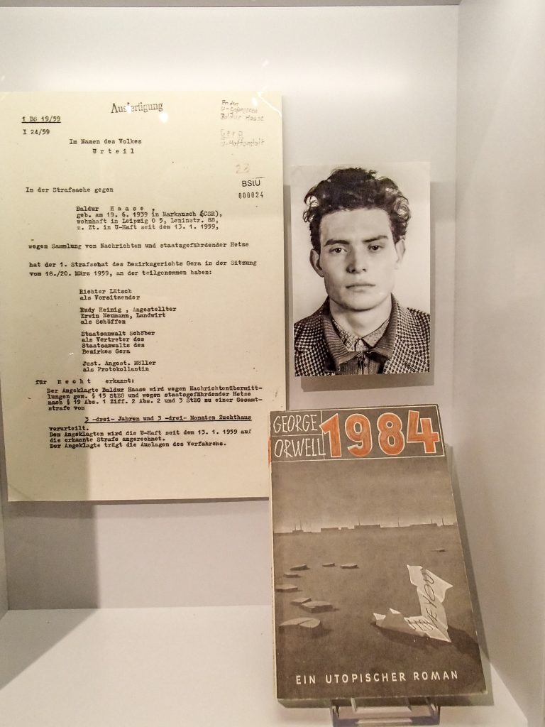
In 1959, 20-year old Baldur Haase was arrested with a copy of George Orwell’s book “1984”. The book was “verboten” in the socialist countries as it was seen as depicting their utopia as a merciless terror system. Orwell was intimately familiar with Stalin’s hatred of Trotsky and the inner workings of a police state. Copies of the book were translated and smuggled behind the Iron Curtain. A penfriend in the West sent Baldur a copy and the young man was overheard talking about the book. A mere eleven years after the publication of “1984”, this young East German was accused of “state-endangering propaganda (Hetze)” and sentenced to a prison term of 3 years and three months. He was released in 1961.
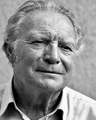
Baldur Haase today.
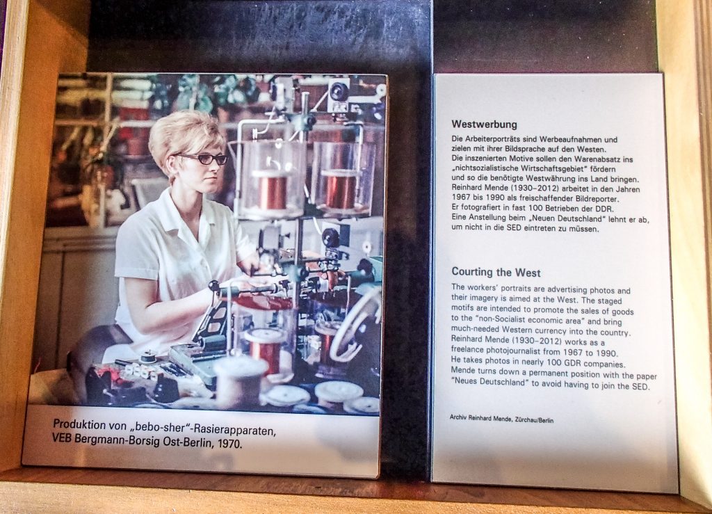
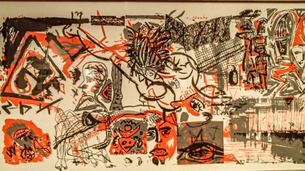
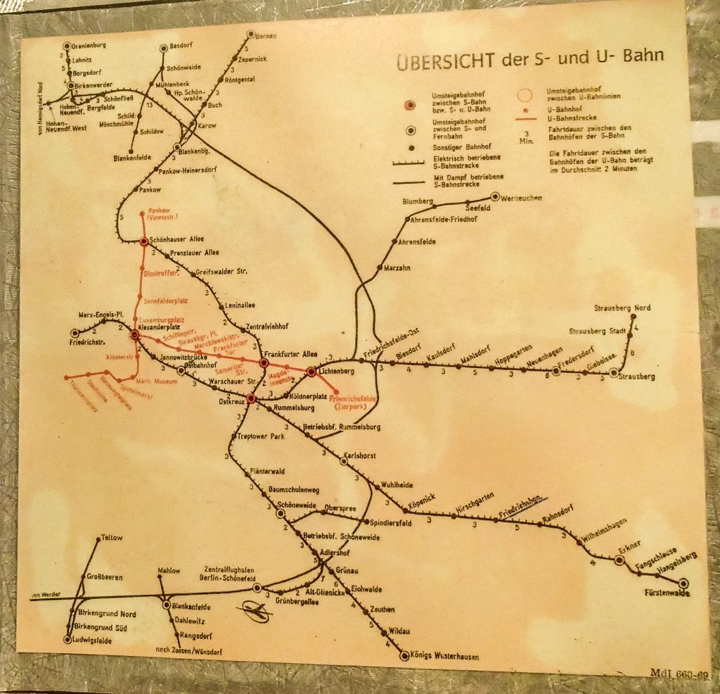
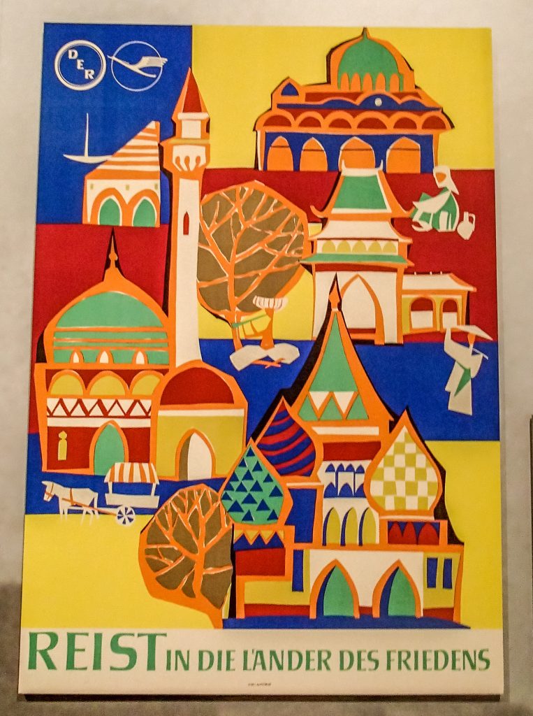
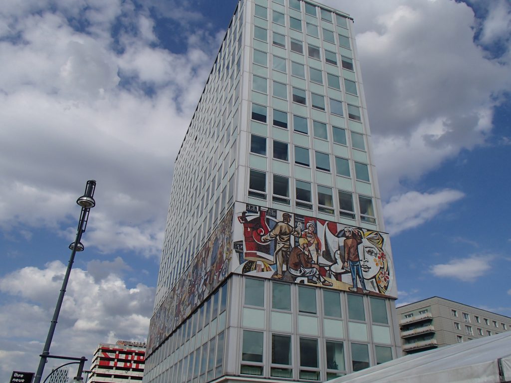
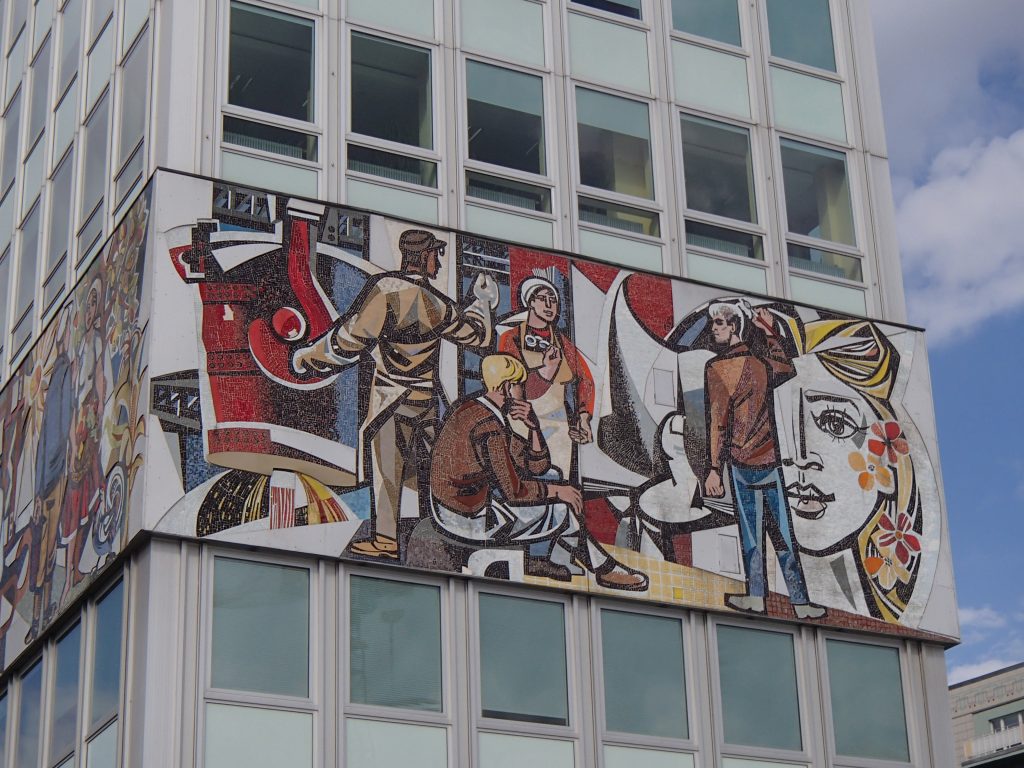
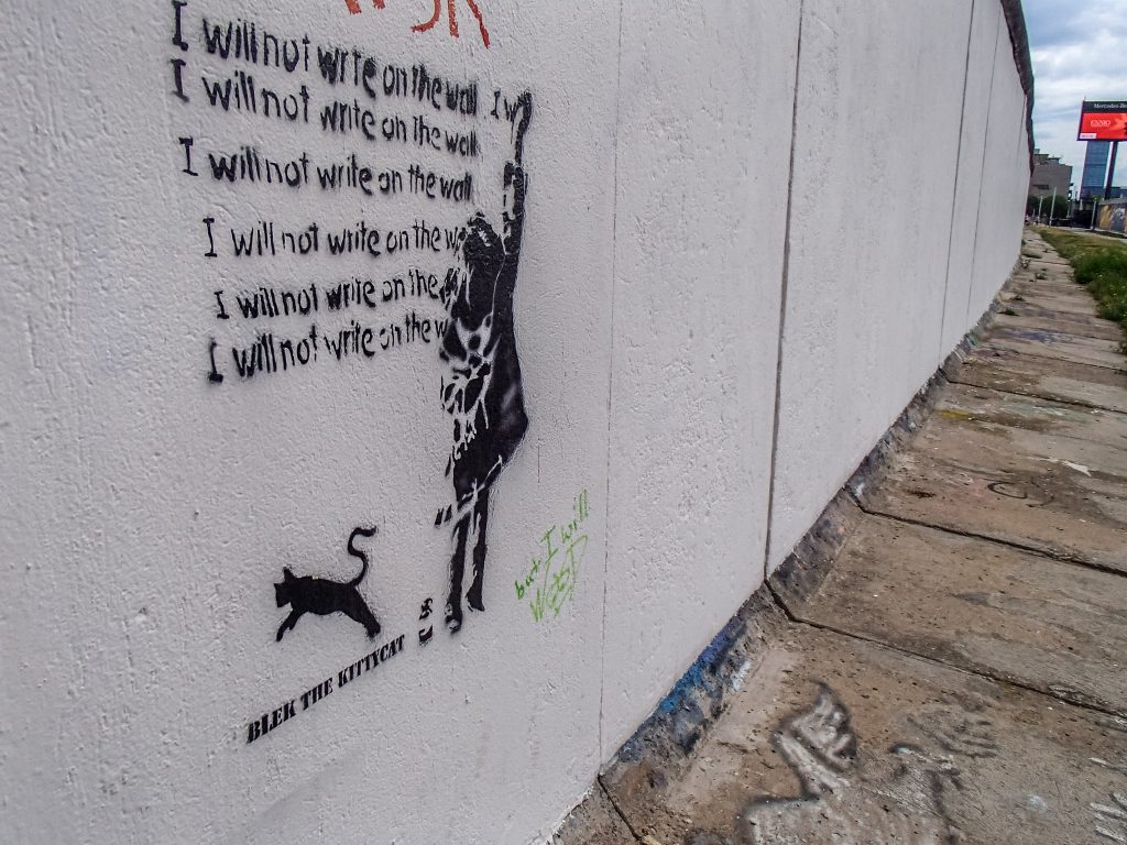
Working in a factory producing razors for export into the NSW – the “non-socialist economic area. East Germany was desperate for hard currency and tried to export quality goods at dumping prices to undercut Western products. Unfortunately, as an internal expert analysis showed, the “bebo-sher” razors remained inadequate and could not be turned into a quality tool. Customers with a choice (in the NSW territory) had better products at their disposal. For many decades, the bureaucrats stubbornly maintained that a planned economy could perform well. They became victims of their own illusion in 1989.The Kulturbrauerei (“culture brewery”) also displays examples of nonconformist art. According to the ruling artistic doctrine of Socialist realism, the average worker or farmer had to understand the artwork, and it had to offer a realistic style and an uplifting message of socialist victory. Apparently, none of these elements were visible in this work of art.A map of the subway and railroad system in East Berlin, undated. Like other traces of utopian systems, what is missing tells you more about the artifact than what you can see. The customer living in East Berlin did not need to see that there was an entire city with plenty of public transport options just to the West of this. The blank space on the left is deliberate “terra incognita” (At least they did not draw lions). Of course, there is no wall. The S-Bahn simply ends at Friedrichstrasse. At least, East Berliners were able to exactly calculate how much time the train needed between stations.Beautifully designed, this poster encourages East German citizens to make conscious choices when traveling. “Travel to the countries of peace”, the text exhorts. Where are those countries? Clearly, the USSR looms large, with the famous St. Basil’s Cathedral and its onion domes. Other countries are depicted with cultural stereotypes. A donkey cart, a half-naked man with a turban playing a flute (India), maybe a Vietnamese woman and an Arab figure next to a jar. The style is socialist Orientalism. Look, although you are not allowed to travel to New York or Paris, there are plenty of exotic locales available to you, if you work hard and show loyalty to the government. Even in their leisure time, Socialist citizens had to be told to use politically correct language. Of course, the state had made a choice for you. The neighboring Socialist countries like Poland, Hungary, Czechoslovakia, Bulgaria and Romania were fine to visit. A few lucky ones had the opportunity to travel farther away, as part of official delegations. “Countries of peace” sounds like a pretty euphemism considering the wars that were ongoing in some of the countries. But the shapes and the color scheme is pretty, and I am sure many East German travel agencies and their (select) customers enjoyed this poster. Note that the East German “Deutsches Reisebuero (DER)” claimed the vintage Lufthansa crane logo to accentuate an alleged continuity from the prewar days.The “Haus des Lehrers” (House of the Teacher) on Alexanderplatz in central Berlin today. The Socialist mosaic-mural hides the library.Educators belonged in the “intelligentsia” category, meaning that they had the responsibility to raise good socialist citizens. In this role, they had to conform to the rigid ideals of the state, enforcing its paternal authority over the people.Along the “East Side Gallery”, a stretch of the former Wall has been whitened to allow visitors to reflect on the forbidden zone. This area was GDR border territory looking west. East Germans had little chance of getting here. You could be shot for approaching the zone. In historical time, there were no graffiti.
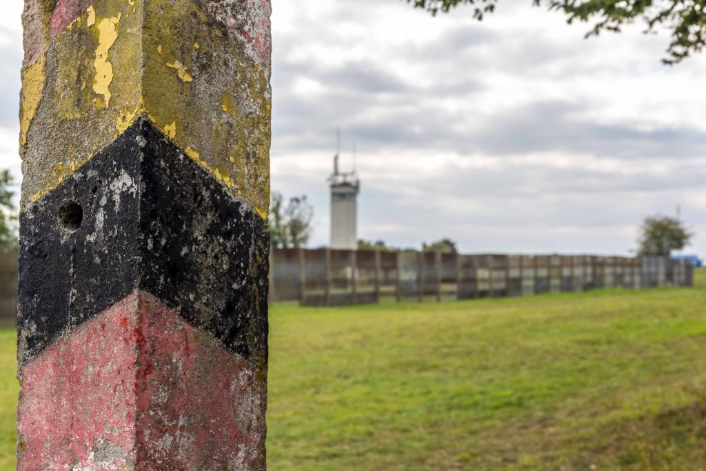
Looking East: The old fence posts reminds visitors of the days of two German states.
This is the center of Germany. Smack in the middle. Along the divide. If you want a taste of what the Cold War looked like, go no further. U.S. troops and Soviets faced one another on a daily basis: Monitoring communications and watching each other’s every movement through binoculars. Today’s peaceful landscape is misleading. At Point Alpha, we are at one of the hot spots of the biggest military confrontation the world has ever seen. Two social systems. Two ideologies. Two massive war machines ready to spring into action at any moment. No compromise.
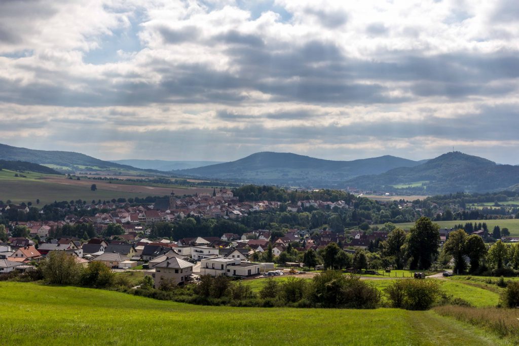
The city of Geisa in Thuringia, the closest town to Point Alpha. One of the most westerly points of East Germany.
Germans have united their country. Over the last thirty years, some of it has grown together. Other parts have drifted apart again. Although society continues to stitch together the two divided entities, there are cracks and seams. This is one of the historic seams. The former border between the Federal Republic and the German Democratic Republic crossed right over this terrain of wheat fields, gentle hills, and forests.
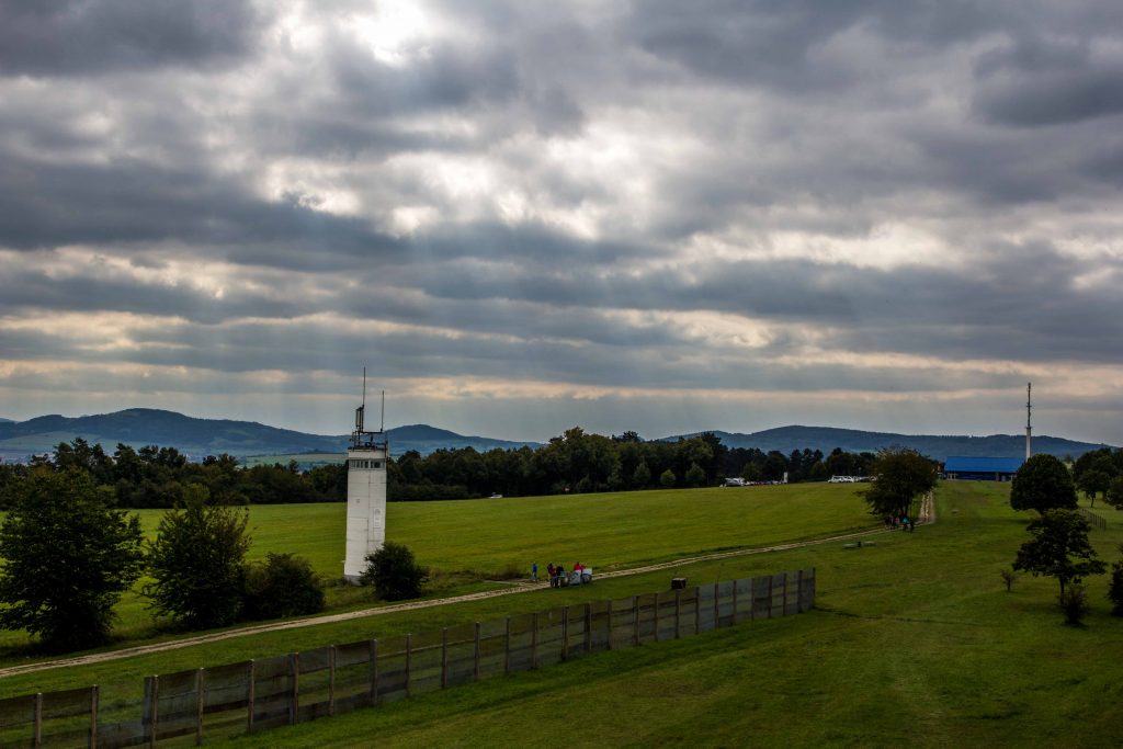
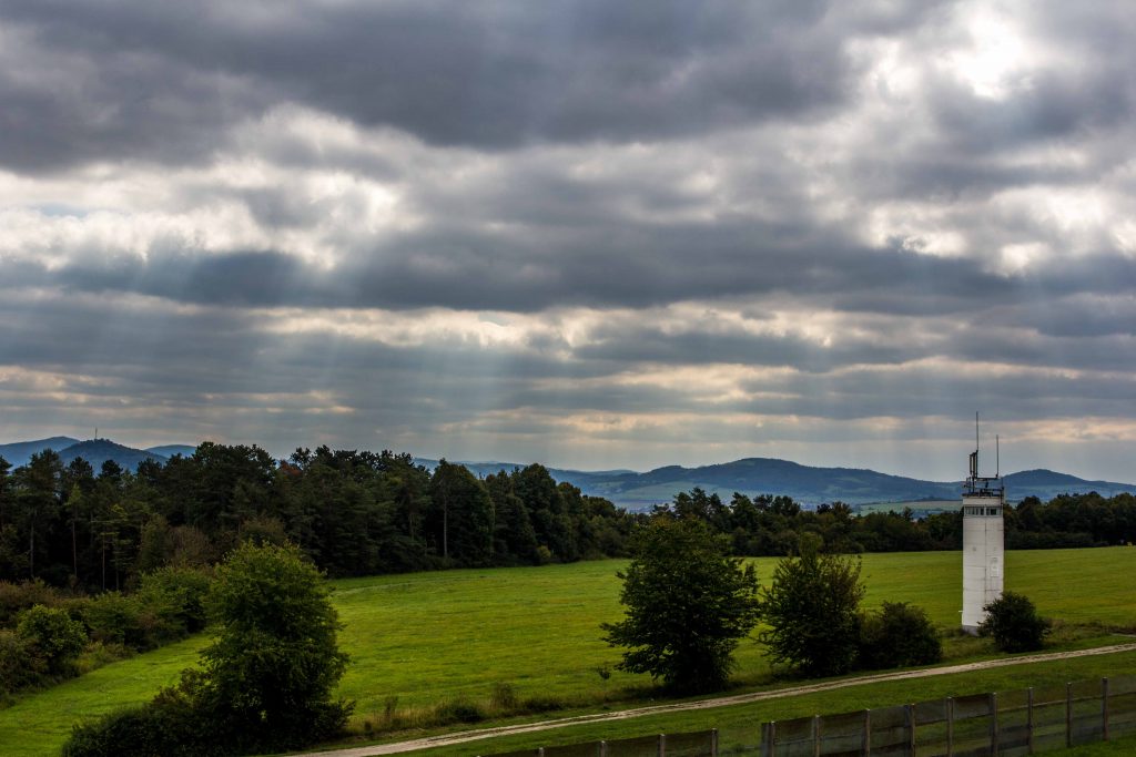
The GI gaze from the U.S. camp: A reconstruction of the border fence, the patrol track and an East German watchtower. On the far right, the visitor center.
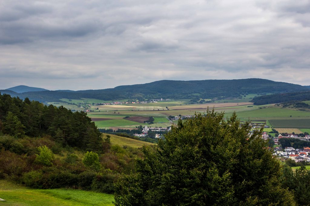
There are no massive peaks or majestic lakes here in the triangle between the states of Hesse, Bavaria and Thuringia. You are exploring what the Germans call “Mittelgebirge”, a medium range of peaks known for its chilly winters and bare summits. The common name is the “Rhön”, a word derived from the Celtic “rann” (mountain) or the ancient Nordic “hraun” (stony land).
It was and is a harsh environment, with freezing temperatures in winter and cool summers. In medieval times, robbers threatened the traveler, and several legends recall Robin Hood-like bandits. Throughout most of its existence, this region was on the periphery of history. The soil does not contain any important natural resources. No significant roads or waterways connect the area with major nodes of trade. Few Germans outside of the area would be able to pinpoint on a map where the Rhön is. Some may have heard of its highest peak, the Wasserkuppe summit: It is the center of German gliding activities, and tourists can book a short flight to get a sense of what birds see. The German heartland is far away from the Romantic Road or the castles along the Rhine.
As you drive through the hills and glens, you come across signs proclaiming that here, on a particular day in 1990, the division of Germany ended. These markers indicate when the border between East and West was opened at this location. They serve as a reminder for current and future generations in a time when the differences have been paved over for the most part. At first glance, you cannot ascertain whether you are in the former East or the former West Germany. Only very careful observation will reveal still existing economic differences: Fields are larger in the East, since land reform expropriated the large estates and state farms took over in the 1950s. In Thuringia, there are many villages without a single store, where itinerant trucks sell bread, sausages and vegetables to the mostly elderly still living here. The young and enterprising have moved or commute to nearby towns and cities.
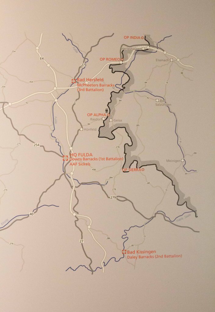
The map shows the military installations guarding the Fulda Gap
For military historians, this is the core area of the Fulda Gap, an area of few natural obstacles for an invading army. Seen as the logical invasion route for Warsaw Pact troops, the Gap became a staple of Cold War planning and popular culture (There is even a board game). Frankfurt, the hub of German industry and banking and the home of U.S. military headquarters, is only 90 km away. The Soviet army distributed its forces across East Germany. As a precaution, NATO dotted the landscape with bases and barracks. The Fulda Gap needed to be plugged to prevent a Red wave engulfing Western Europe. Along the Eastern side, the Communist regime moved people around like pawns in a chess game. East Berlin created a no-man’s land dedicated to border security. On the Western side, there was no such government intervention. Of course, the economy suffered. Commercial routes were cut off suddenly. But the impact was manageable, except for the heavy military presence. NATO tanks tore up the soil during maneuvers, and German taxpayers compensated the villagers for any damage. In many areas, the natural environment was off limits. Summits were cordoned off for hikers and the militaries of each side transformed large stretches of land into camps and massive training territories.
The border line itself was the result of Allied agreements in 1945. By the end of the Second World War, U.S. troops had marched deep into Thuringia and even installed mayors in many towns. The spot where the Allied militaries met -Torgau on the Elbe river – lies deep in Mitteldeutschland, close to Berlin. But the Big Three -Roosevelt, Churchill, and Stalin- had compromised on the state line of Thuringia and Hesse as the border between their respective zones of occupation, and the U.S. Army withdrew again. At that time, it looked as if this relocation would have little consequence. Surely, the Allies would agree on a joint policy regarding Germany soon. But with tensions rising and the Cold War getting uglier in 1947, the strictly administrative line soon became the border between two hostile systems. When two German states were established in 1949, this line marked the border of the German Democratic Republic (GDR), buttressed by hundreds of thousands of Soviet troops. But it also marked the dividing line between democracy and Communism – the “Iron Curtain”.
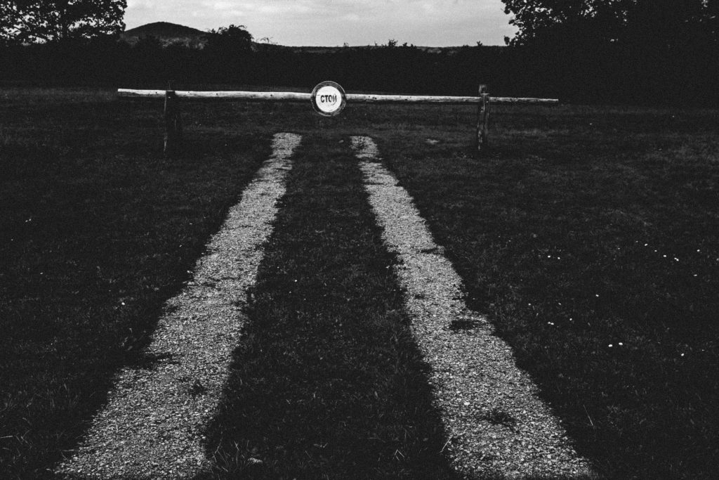
The Russian stop sign represents the end of the road.
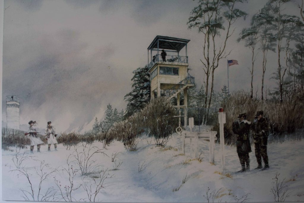
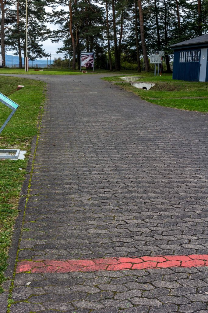
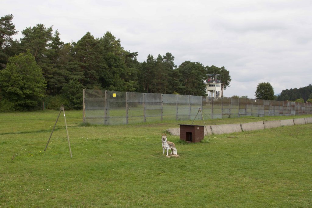
To keep the border secure, the GDR government completely changed the structure of the rural society. Farms close to the barbed wire were destroyed and the inhabitants and their livestock relocated. A border regime regulated who could enter the exclusion zone. Anyone suspected of harboring anti-Communist views had to face arrest and deportation. Along the fence, the guards developed a perfect system to prevent any GDR citizen from escaping. Watchtowers allowed for a direct view of the nearby fields and hills. Any enterprising person attempting to flee the country would have to make his or her way through an obstacle course of fences and minefields. In case anyone attempted to “flee the Republic” – the official designation – searchlights alerted the garrison. Guards would drive their Trabant patrol cars on a special track to catch the culprit. By that time, a self-triggering spring gun might have already killed the unlucky escapee. Officially, of course, the security was needed in case of a surprise NATO attack on the “peace-loving” GDR.
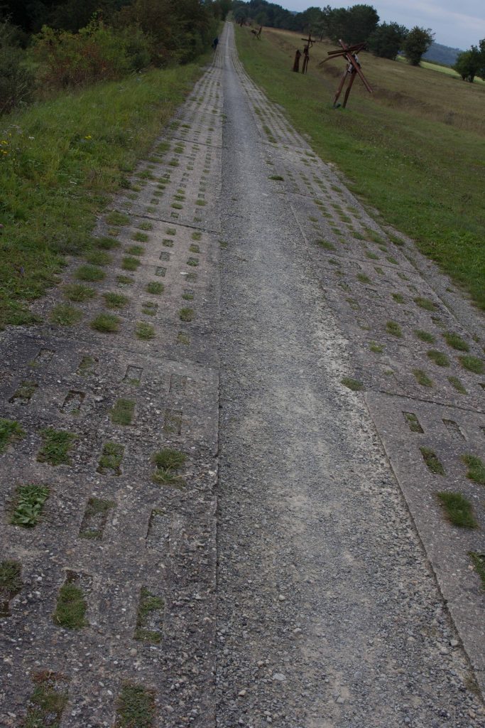
The patrol track for border guards now with modern art installations.
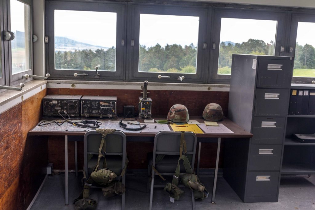
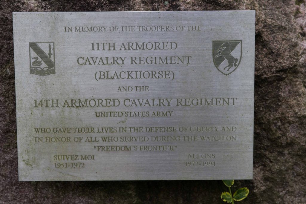
Faced with the “Iron Curtain” and an expansionist Communist threat, the West could not afford to be left in the dark. In addition to sending spies across the divide, the United States and its Allies established a network of monitoring stations to listen in on Warsaw Pact movements. Several high-tech radar facilities on the Wasserkuppe summit at an elevation of 900 meters attempted to capture Communist communications deep inside the GDR. On the border, the West needed another puzzle piece. Observation Point (OP) Alpha was established as the first of several forward observation posts, situated on an elevation of 411 meters. Afterwards, OP Romeo, OP Oscar and OP India were built. In 1972, the 11th Armored Cavalry Regiment “Blackhorse” took over. One platoon of armored cavalry was stationed here, with ten vehicles. About forty men were deployed here in regular times, up to 200 could be on duty in times of crisis.
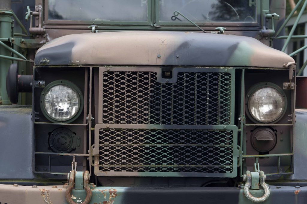
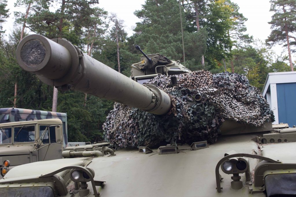
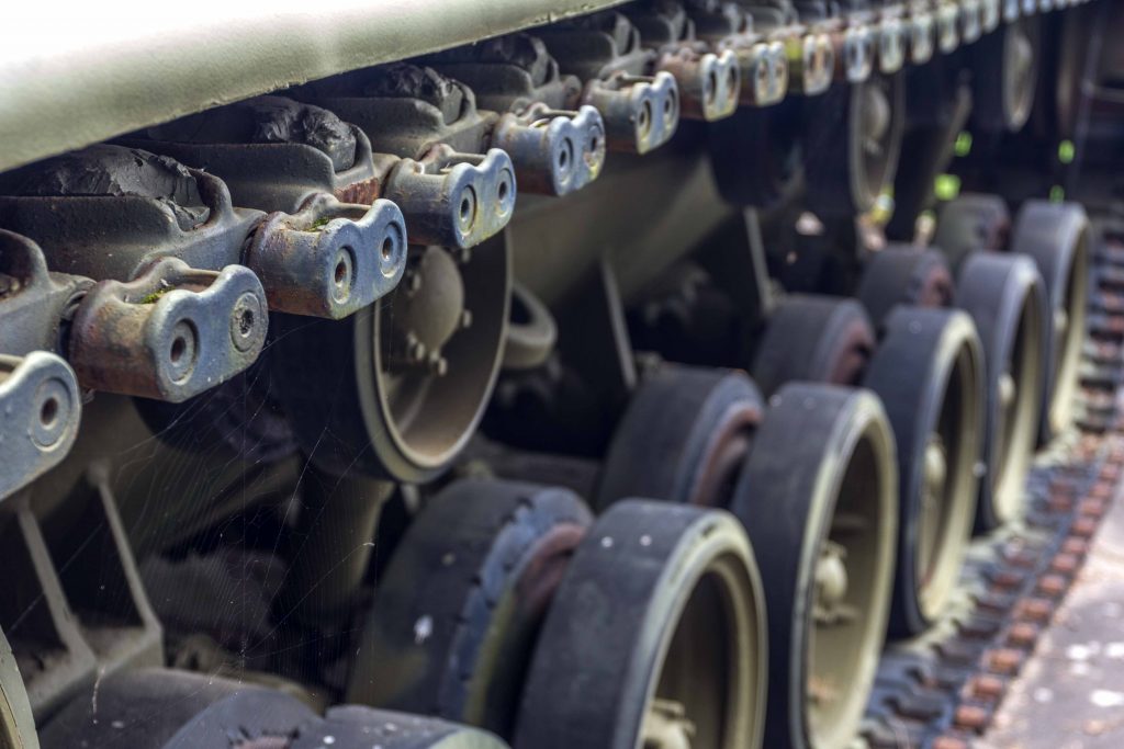
Camp Alpha displays some military vehicles from the Cold War period.These tanks would have been used for self-defense in case of an invasion.
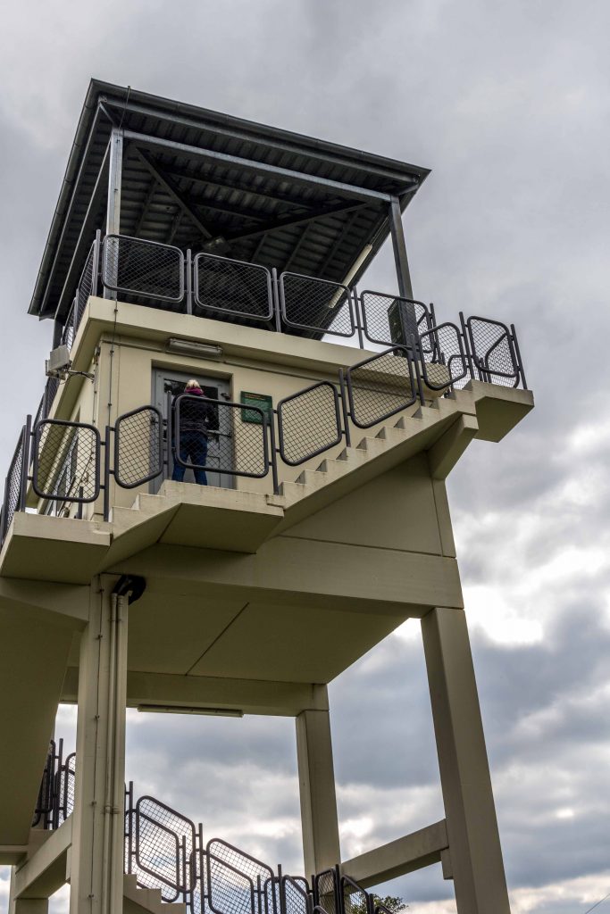
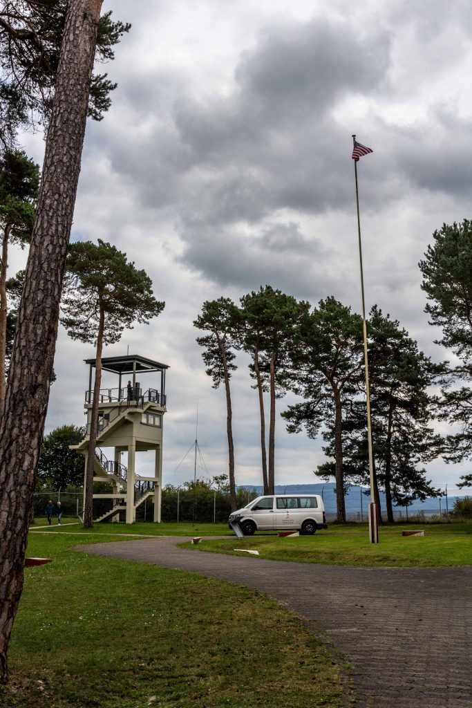
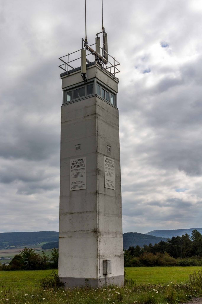
This spot right on the border was not intended to be a combat position. But it was needed to get a sense of what the Warsaw Pact was planning. Point Alpha was part of the advance warning system. In 1985, a new concrete tower was built which is still standing. From here, the soldiers could observe activities on the other side of the divide. The AN/PPS-5 ground surveillance radar allowed the U.S. army to detect a tank from 10 km away. Should the Reds invade, the men and women stationed here would observe some preparations and raise the alarm. In case of invasion, they would quickly retreat. Or so it was planned.
The U.S. watchtower at Camp Alpha, built in 1985A peek inside the U.S. Army observation post
The Fulda Gap was the site of potential nuclear warfare. Faced with an overwhelming conventional force, NATO reserved the right to answer an attack with tactical nuclear bombs, some as small as a large suitcase. The bucolic scenery would have been transformed into a post-Armageddon moonscape. Fortunately, it never came to this kind of escalation. The doctrine of deterrence worked.
Commemorative plaque at Camp AlphaNo fence separated troops on patrol. They had to tread carefully. Note the cross commemorating a victim of Cold War confrontations. Painting inside the Black Horse Inn, Camp Alpha
With the Cold War over, the landscape has recovered, and it is all peaceful here. Military listening stations and observation posts have been dismantled or have become museums. In 1991, the U.S. gave up Point Alpha. After housing asylum seekers, the future of the installations seemed bleak. The local government planned to raze the buildings and let nature reconquer the site. Fortunately, a protest movement prevented the destruction. Concerned citizens wanted to preserve the memory of divided Germany.
Stars and Stripes are kept flying: Camp Alpha
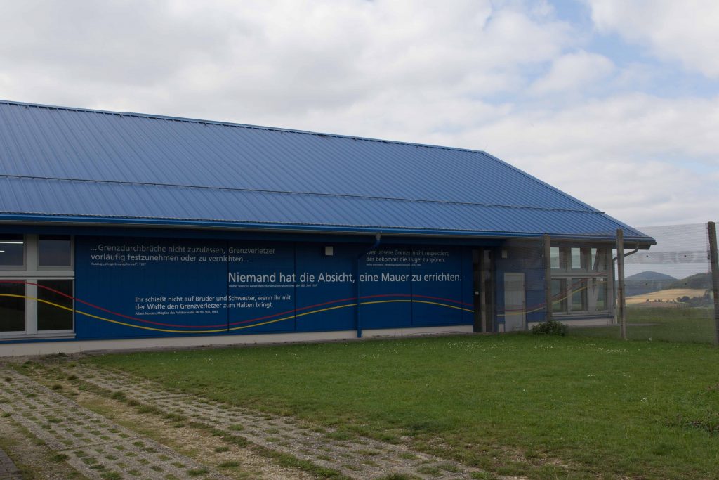
Instead of getting demolished, the buildings continue to serve a critical function. The Point Alpha foundation oversees a large complex with fascinating artefacts, inviting schoolchildren and history buffs to ponder the Cold War era. The museum displays the Warsaw Pact invasion plan right through the Fulda Gap, last updated in September 1989.
No longer on alert
Regularly, the German government invites American teachers to tour the area for some first-hand experience of the Cold War confrontation in Europe. It is part of the Transatlantic Outreach Program (TOP). West Point graduates also visit to get a glimpse of Point Alpha’s significance in history. Once a year, the U.S. flag is exchanged in a special ceremony.
The casual observer can become a Wanderer between the worlds, consuming a hamburger on the former U.S. camp in the aptly named Black Horse Inn or taste a Russian-legacy solyanka soup in the former East German city of Meiningen. You can visit Point Alpha or its less impressive Soviet counterpart Hohe Geba on the Thuringian side. A mesmerizing mural inside the Black Horse Inn depicts Soviet and U.S. soldiers on patrol carefully watching each other in the snowy landscape.
The red stripe indicates where vehicles had to stop to prevent a misunderstanding at the border
Memory locations have sprung up like mushrooms to remind the young of the fissures of the past. Art installations commemorate the hardships of a divided country. The former death strip has morphed into a huge Green Belt of nature preserves. Because it was off limits during the conflict, several endangered animals and plants have survived here, and now they enjoy protection. This is true for other parts of the Rhön as well, which is now an official UNESCO biosphere preserve. Several elevated moors such as the Red or the Black moor are famous as nature destinations and sanctuaries for very rare species.
View from the East. Notice the replica dogThe border between Hesse and Thuringia is very picturesque
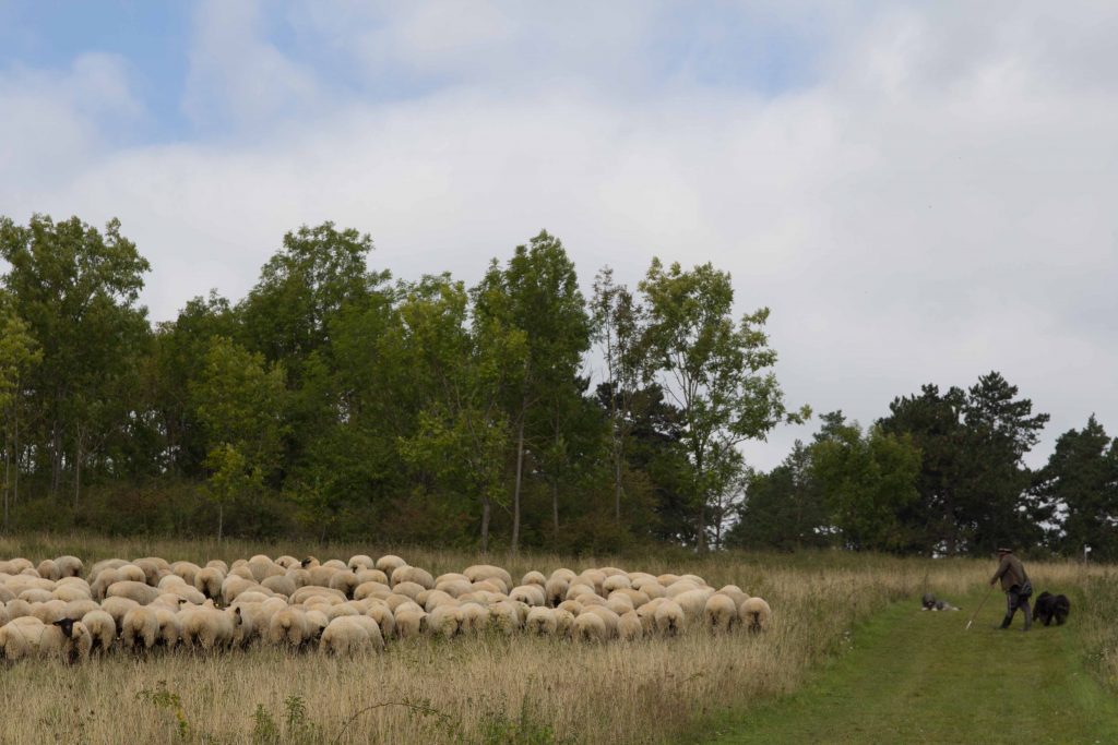
Sheep are common as the Rhön’s signature animal. Like elsewhere, they are not raised to produce wool or meat. Their wool is too scratchy for cashmere-spoiled customers. Lamb is uncommon on German tables. Besides, it is not worth competing with agro-industrial corporations. Instead, they are keeping the heath landscape from overgrowing and the forest from covering the hillsides. Count yourself lucky if you stumble upon a flock guarded by smart sheep dogs.
A chance encounter with the famous Rhönschaf
Currently, the Rhön is a hiker’s paradise: easy-to-moderate hikes of all lengths, plenty of castle ruins, and quaint village inns to quench your thirst. It is off the beaten track, unlike Point Alpha during the Cold War.
No longer a dividing lineThe Visitor Center at Point Alpha offers historical explanationsThe East German watchtower is now a historic monumentWhere people used to get shot, a monument is pleading for peace between the nations.
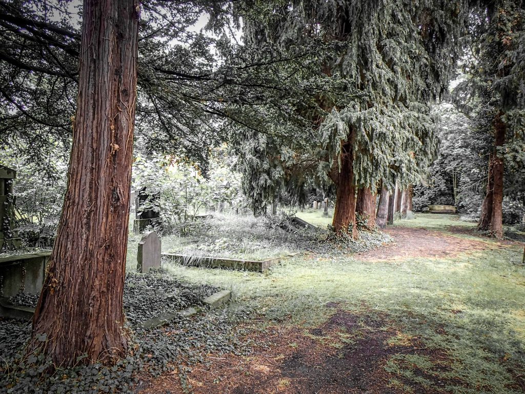
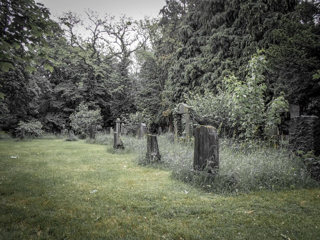
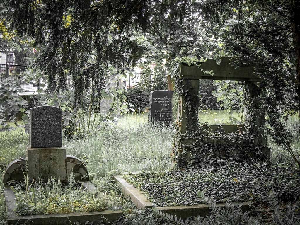
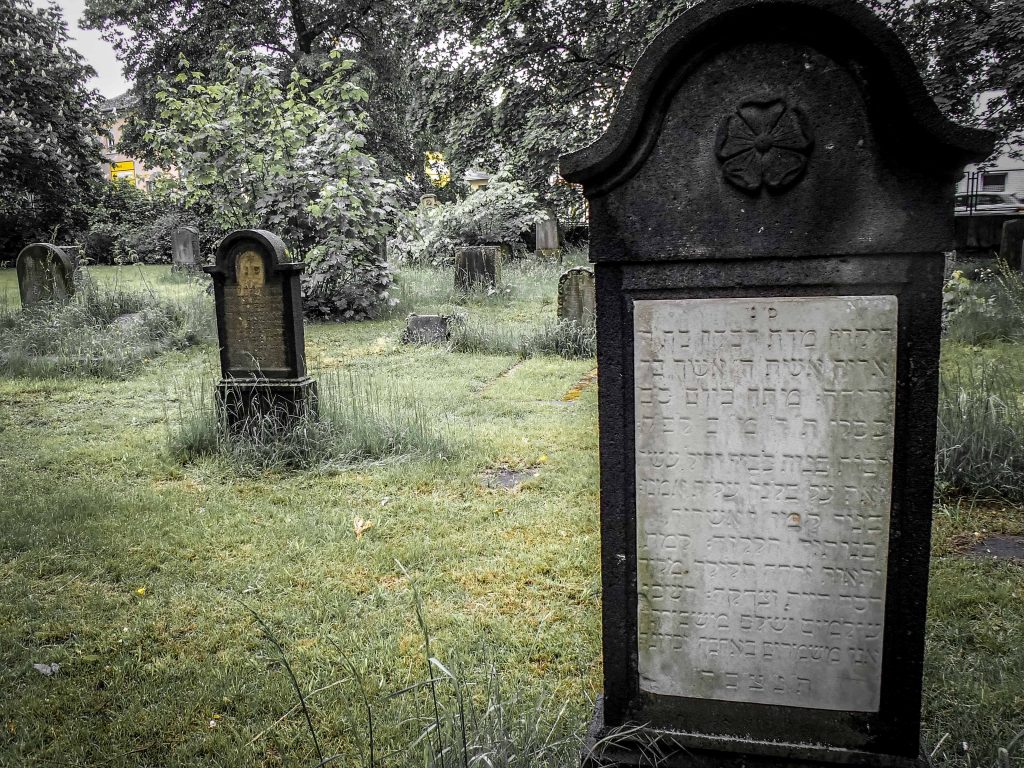
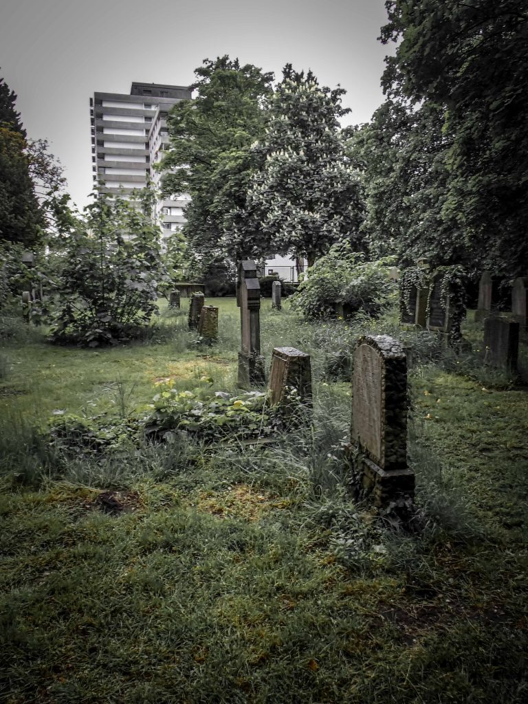
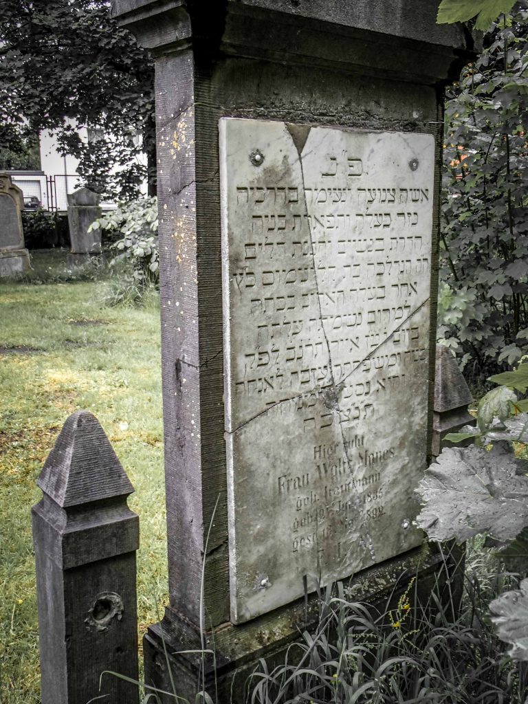
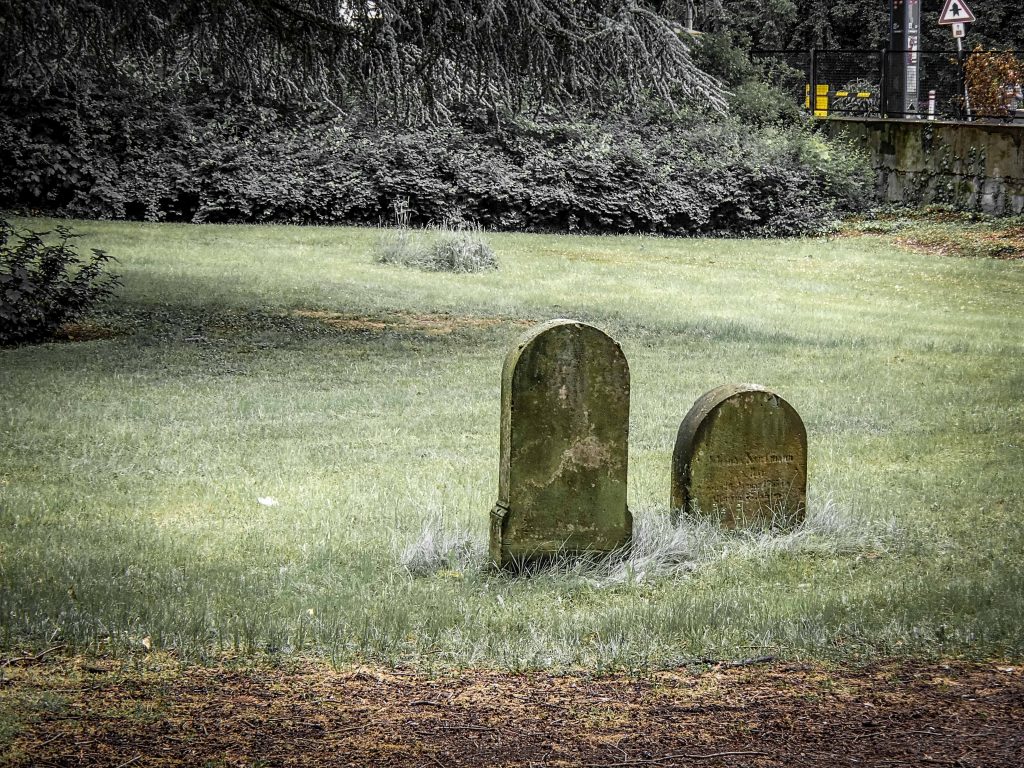
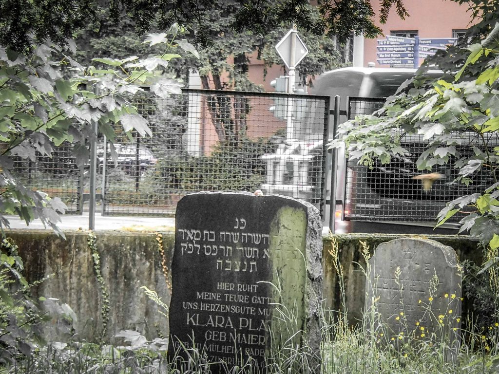
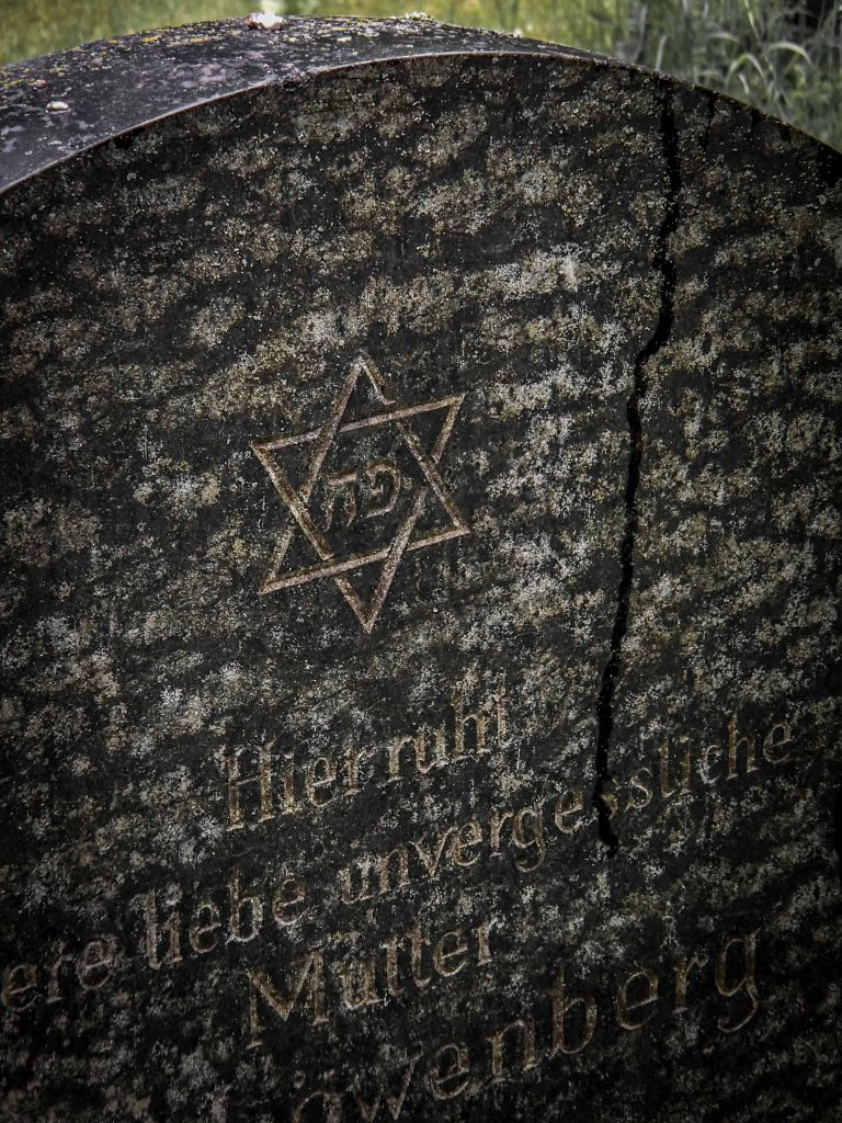
This year, Germany celebrates 1700 years of Jewish life. The oldest mention dates back to an edict by Emperor Constantin from the year 321, stipulating that Cologne Jews could and should serve in the city administration. The life of a religious minority within a Christian society was never without challenges. Periods of coexistence and good neighborhood were undermined by draconian laws, persecution and outbursts of violence directed against Jews. Once we zoom in on one community, we see similarities and differences. There are about 2,000 Jewish cemeteries in Germany, an indication of the long heritage of Jewish heritage between Elbe and Rhine. The small city of Bruehl (45,000 inhabitants), once the residence of powerful Archbishop and Kurfuerst Clemens August (1700-1761), had a vibrant Jewish community as well. As is common for post-Nazi Germany, you need to visit the cemetery to find out more. Let’s have a look.
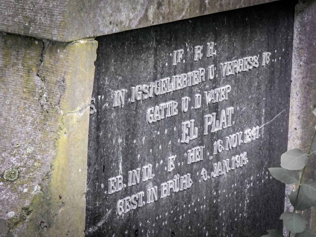
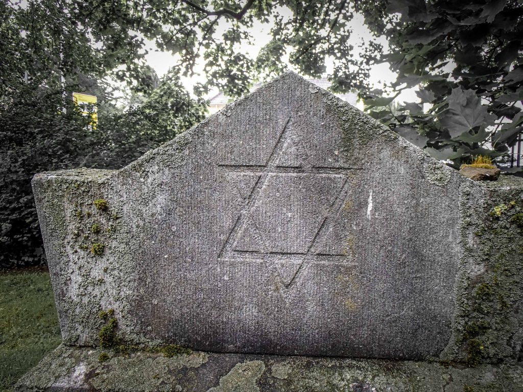
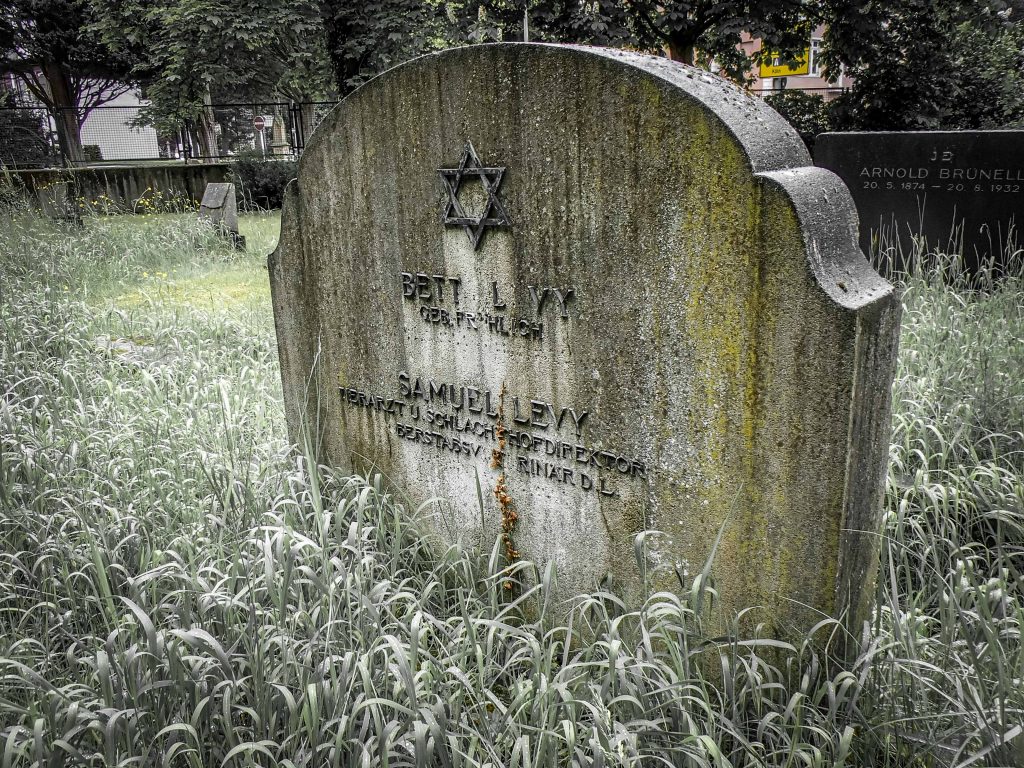
A touch of California: Redwood trees line the graves, The cemetery dates back to 1371.Access allowed: the city takes care of the site and welcomes visitorsJews had been living in Bruehl ever since the city was founded before 1285.Between 50 to 170 Jews lived in Bruehl, according to official accounts. About 90 grave markers remain on a plot of 4,000 square meters. The size makes it one of the largest remaining Jewish cemeteries in the Rhineland.Jews were cattle or horse traders, ran butcher shops and textile stores. They were eventually the target of a boycott campaign by local Nazi fanaticsMost markers (Mazuwot) date back to the years 1880-1914. The oldest Mazuwot is from 1746, the most recent from 1946.In 1938 the Jewish synagogue was burned down.Veterinarian Samuel Levy became head of the local slaughterhouse and earned the distinguished title “Oberstabsveterinaer”, indicating the rank of a serving officer in the military.This Mazuwot commemorates Johanna Kaufmann, owner of a butcher shop, who died in 1892. It calls her the “tiara of her husband and the pride of her children”The plot of the cemetery lies just outside the medieval city boundaries.The Jewish cemetery occupies a small corner lot near a busy intersection. It is quite close to the Schloss Augustusburg and the pedestrian zone. In October 1944, the Nazis deported all the Jews living in Bruehl. Approximately 65 men, women and children were murdered. A Jewish community does not exist today here. But the city offers events commemorating the Jewish heritage and marks the destruction of the synagogue with a nighttime vigil every year. An online database preserves the memory of every single person mentioned on the markers and combines all the evidence on their lives.
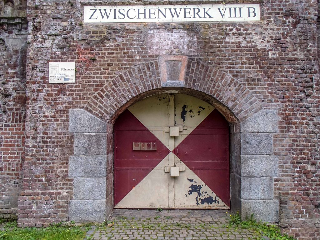
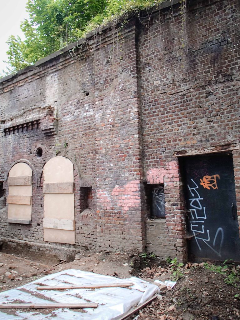
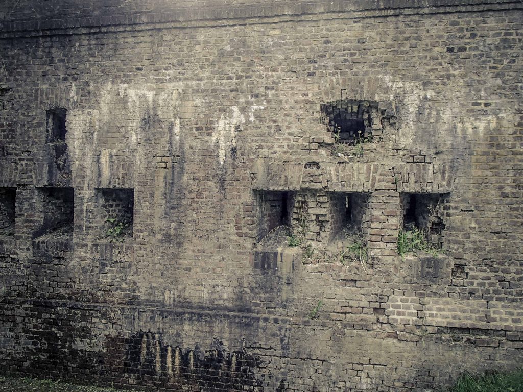
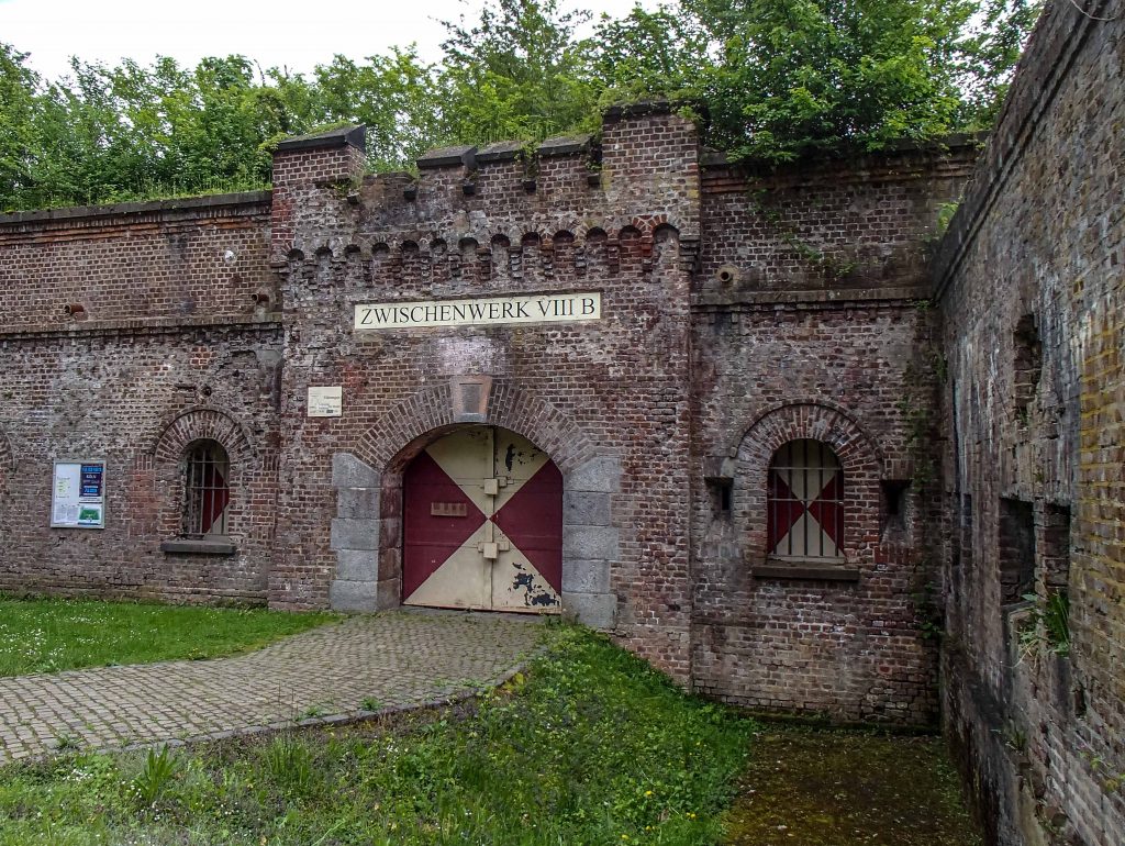
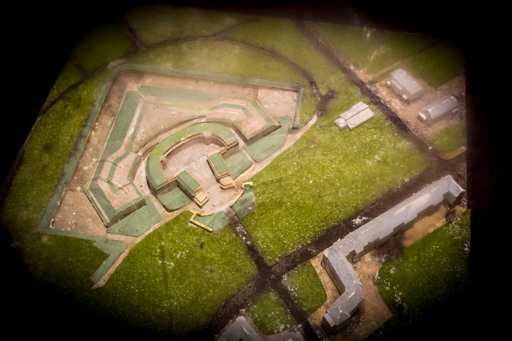
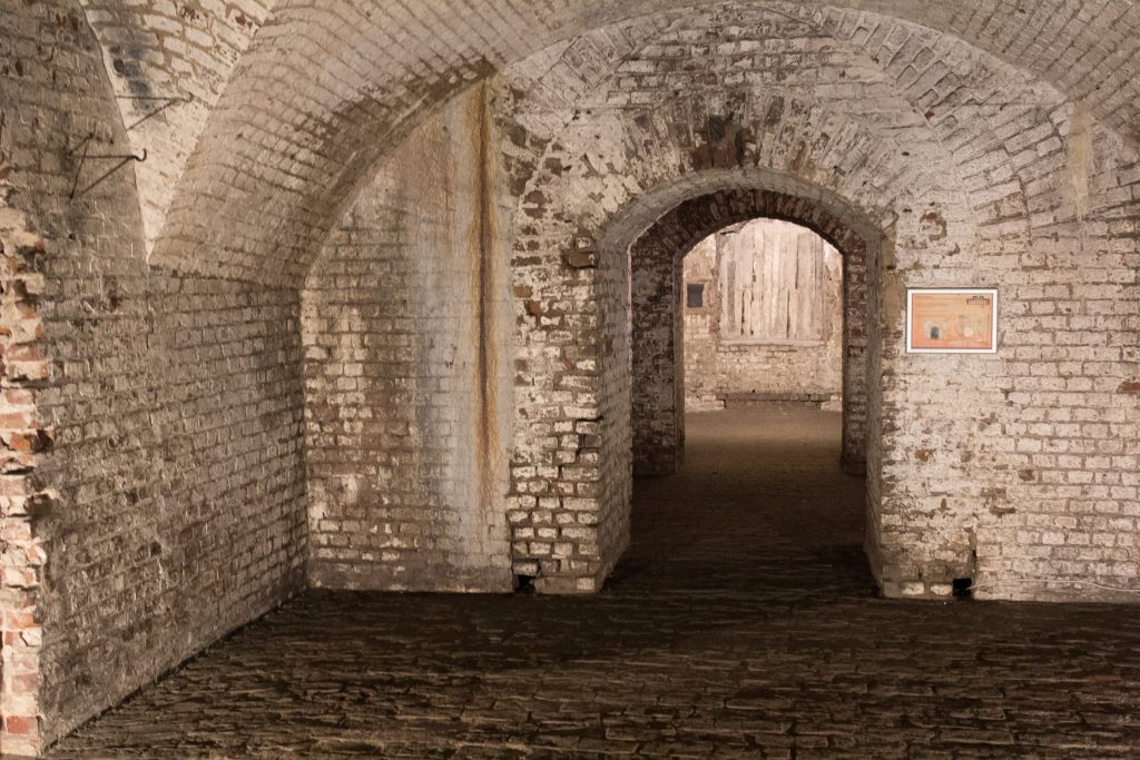
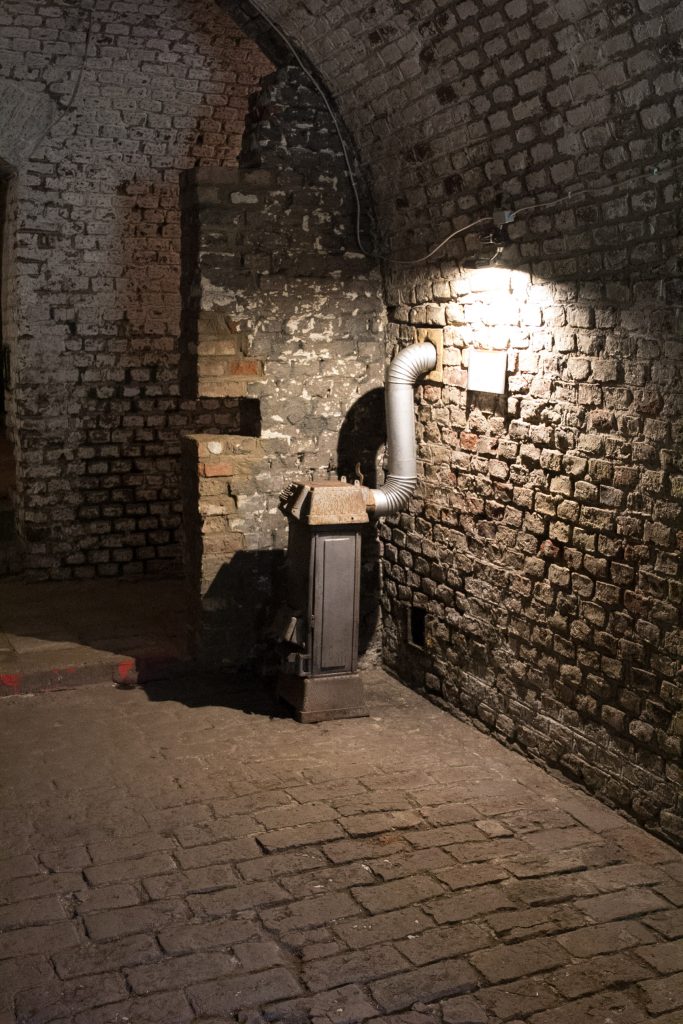
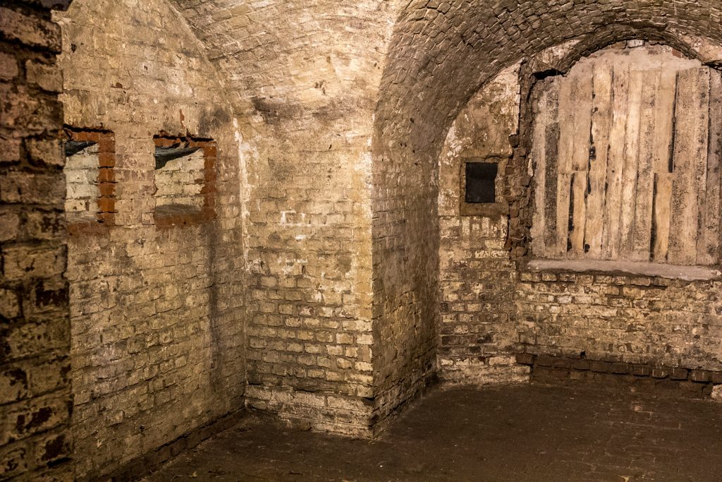
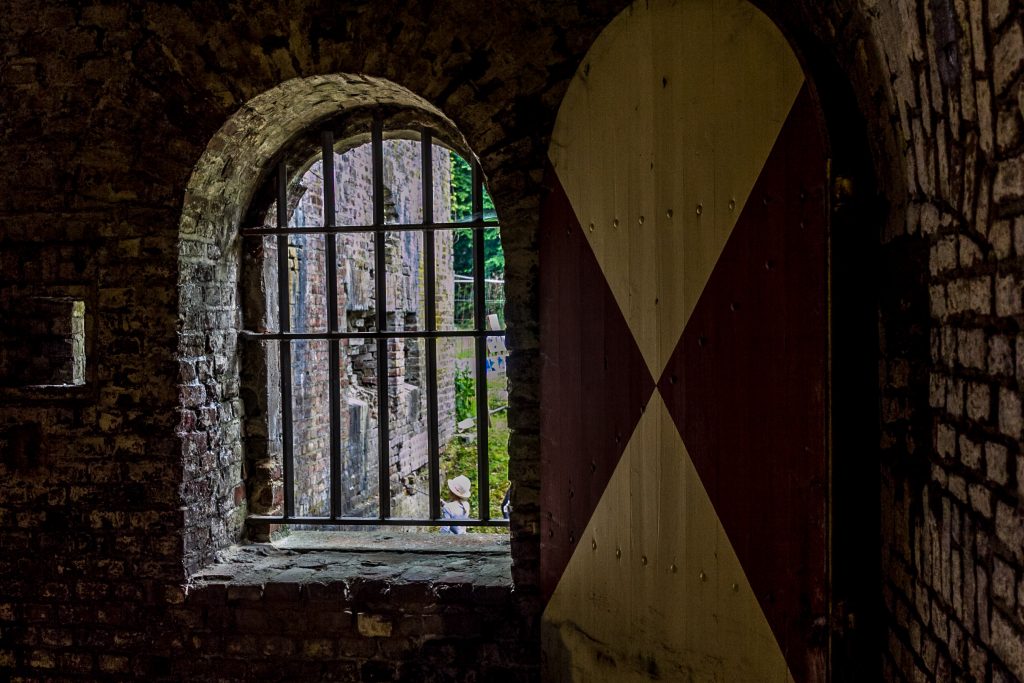
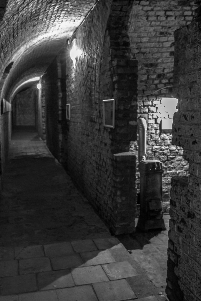
The Zwischenwerk (intermediate fort) VIIIb is one of the remains of a massive belt of fortifications around Cologne, established in the years 1873-76, to guard against a French invasion. Twelve large forts were constructed, with some additional flanking or intermediate forts. Most of these had to be dismantled after the First World War, according to the stipulations of the Versailles Treaty. Today, a museum preserves this military memory. The fortress belt around the city is not completely visible but needs to be discovered. The specific fortresses were made of red bricks and then covered in earth or concrete.
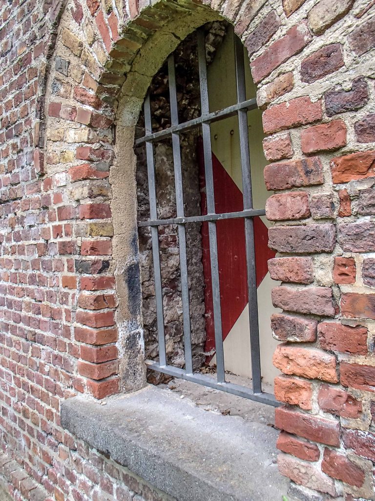
The windows are protected with an iron grill
All of them have similar designs. Interestingly, the Zwischenwerk resembles the forts constructed in Posen (Poznan) and Thorn (Torun) in today’s Poland. Apparently, Prussian military engineers felt a standard design had many advantages and both the prospective French and Russian enemy would not be able to penetrate these defensive lines. A deep dry moat protected the main body of the fortress.
The dry moat was dug more than 4 meters into the ground.
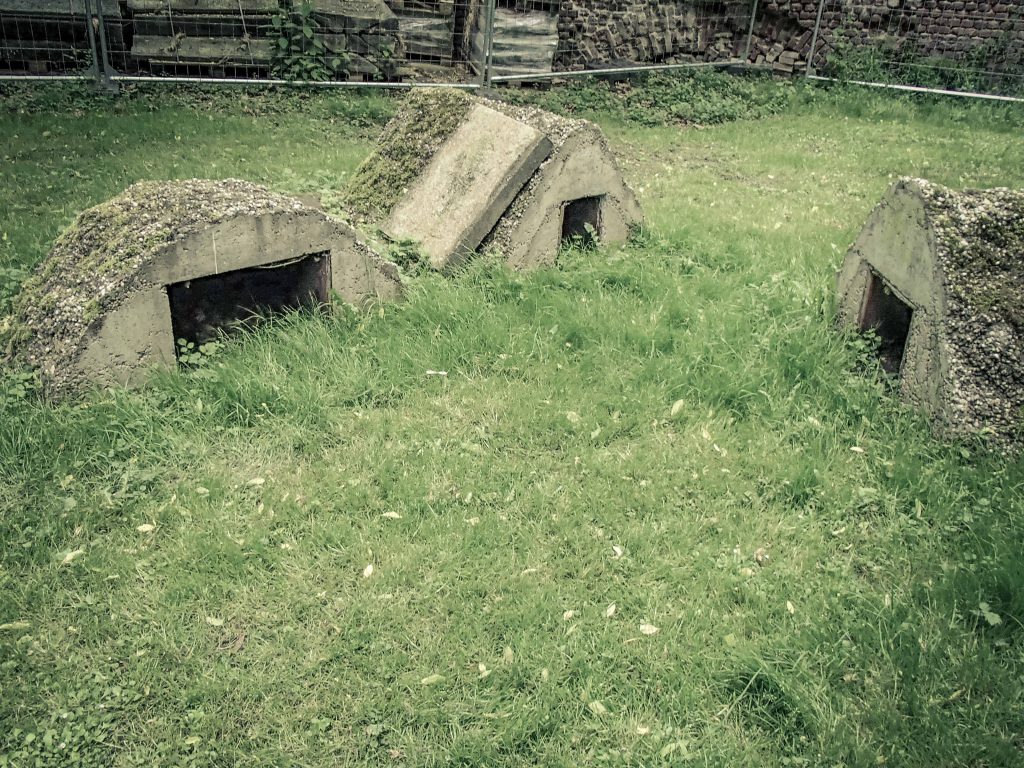
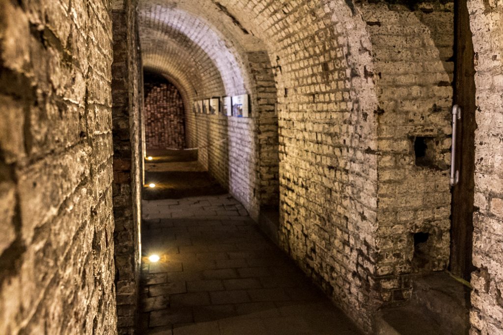
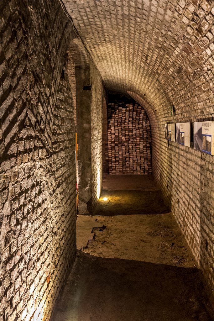
In addition, an iron fence held off potential attackers. A 15 cm gun was the main weapon, with three additional smaller cannon installed. Plenty of ammunition was stored inside the area, shielded by heavy brick walls and small bunkers.
Munitions storage in specially designed bunkers
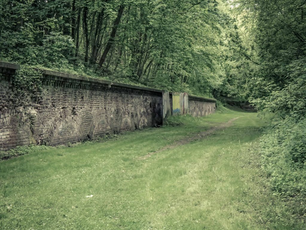
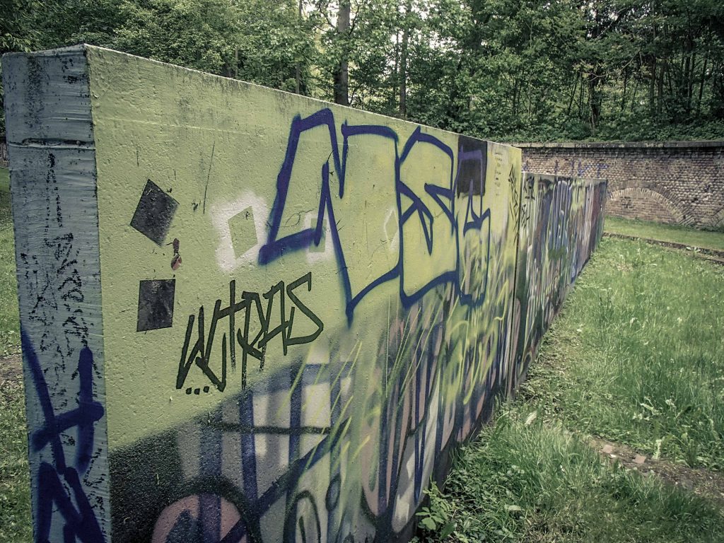
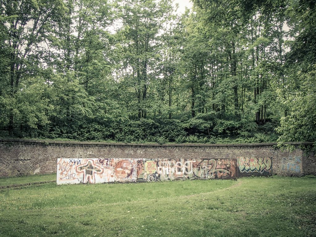
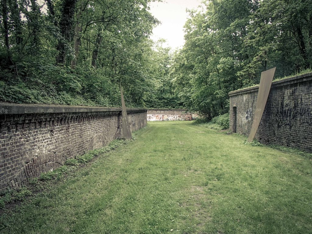
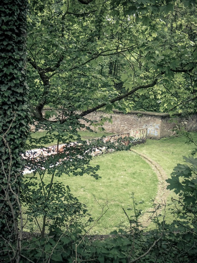
About 150 soldiers occupied the fort. No shot was ever fired in anger here since France never invaded and the battlefields of the “Great War” were far away in Flanders. Germany lost, the newly-established Weimar Republic had to downsize its military and demolish fortresses. The Rhineland became a demilitarized zone, enforce by Allied occupation. After the required dismantling of defensive installations, the area became a green belt and a public park. Unfortunately, it has also been heavily tagged and littered, making it unsightly and seemingly neglected.
Public art defaced by taggers
The local fortress aficionados are currently collecting money to pay for the upkeep. CRIFA – the Cologne Research Institute for Fortress Architecture works on an international basis to preserve the history of military installations. However, Prussian heritage protection is not the most popular item on the agenda of today’s political elite in Germany, and in the anti-Prussian Rhineland in particular. This is visible – the area is completely open to the public and unguarded. Young Germans obviously have little regard or respect for their heritage. As a consequence, the walls are covered in tags and the whole space is full of trash. A sorry state for a proud city. If you are lucky to catch a rare open day or visit on the international “Day of Forts”, you might be able to see the barrack rooms and the kitchen inside.
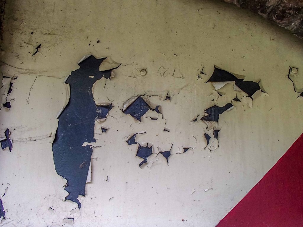
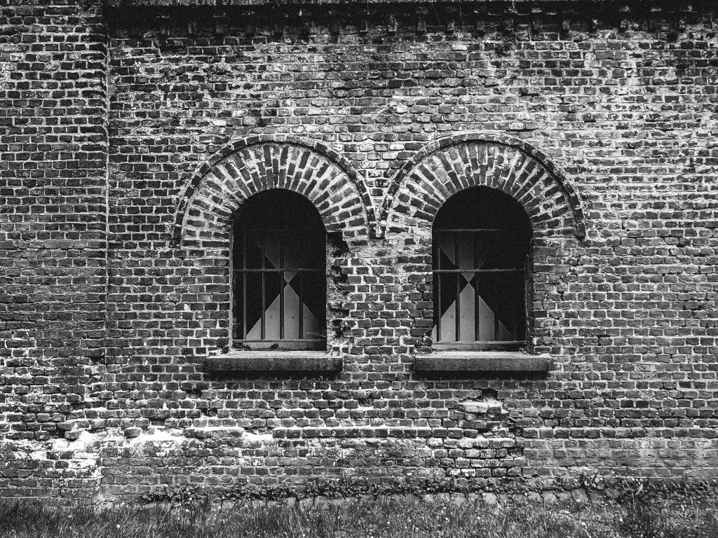
Public spaces soon become the playground of vandalsSteel shards placed strategically inside the moat are what remains of an art projectA view from the overgrown forest around the fortressPreservation is continuing amidst constant vandalism at the historic sitePeeling paint is the least of all the conservation issues hereMore than a century has passed since these bricks were laid downThe view for the French: Impressive embrasures for firing at the enemyTwin windows to shed light into the fortress
The goal of Zwischenwerk VIIIb was to protect the nearby Rhine river, which is indeed within walking distance from the fortress. Nowadays, a popular main road transports cars and trucks to the Autobahn. Most drivers will be oblivious of the military installation on the side of the road.
Now, a look inside! Once a year, the “day of the forts” celebrates the remains of fortifications across Europe. Organized tours allow a glimpse behind the walls.
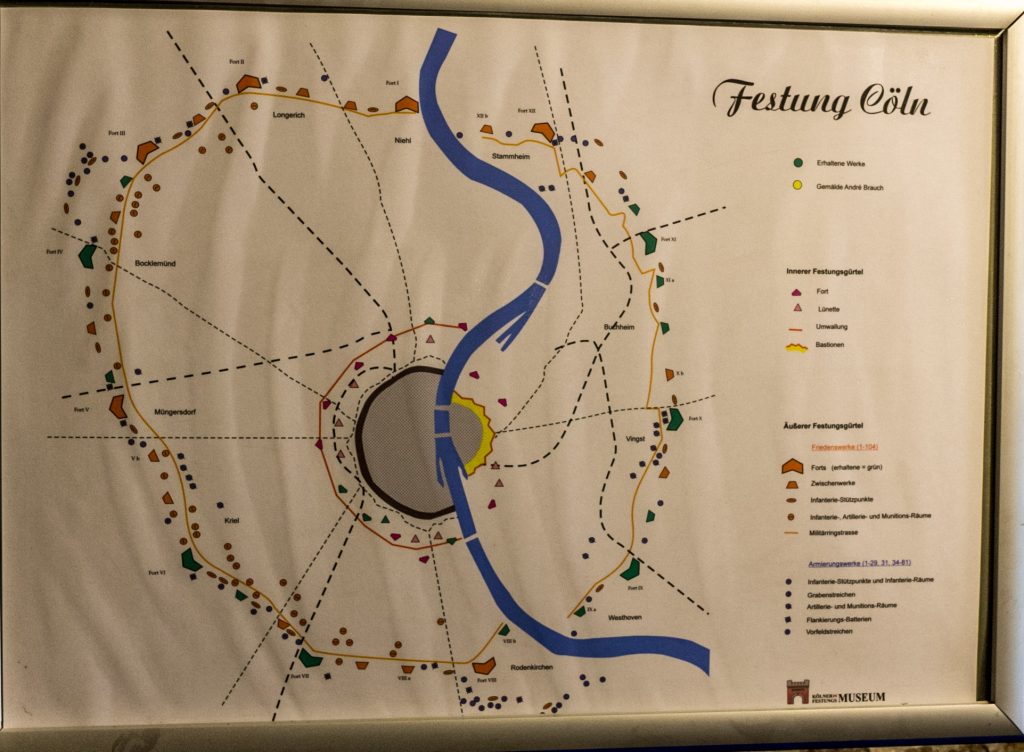
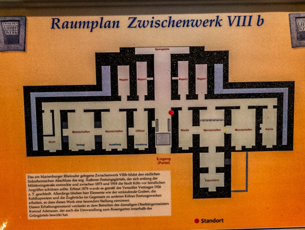
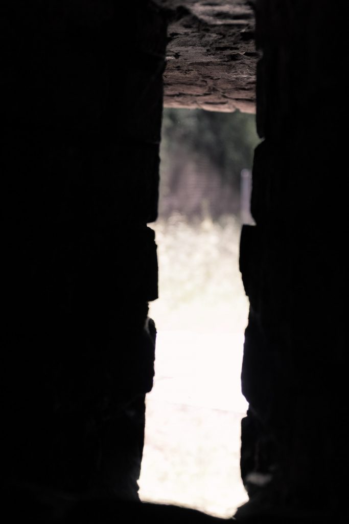
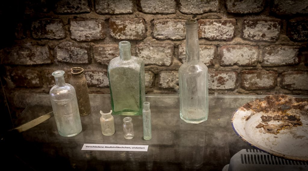
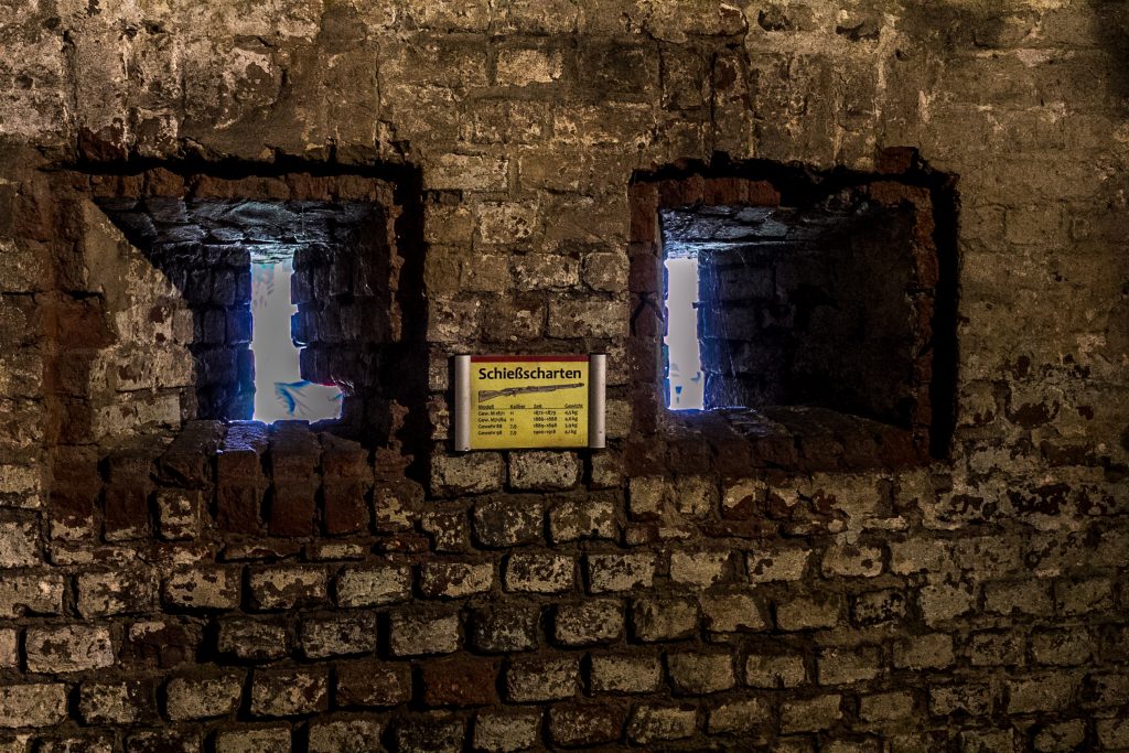
A nonprofit maintains the interior and has organized a small but lively exhibit.The guides do a wonderful job explaining how this fort as used in the strategic defense of the city of Cologne. The most significant strategic value were the two bridges crossing the Rhine. At the time (1880s), armies found river crossings extremely difficult. Therefore, campaigns were directed at capturing bridges intact. Besides the two bridges in Cologne, the next Rhine bridges were at Koblenz (south) and Wesel (north)The fortification belt went all around the city, and a special road, the “Militaerring” was built to connect them. Our “Zwischenwerk” in Rodenkirchen is located on the bottom of this map. Mark the two bridges over the river Rhine.This scale model shows the fort with its steep moat and triangular shape pointing to the advancing enemy.Although the fort was built to last, water still seeps in and threatens the brick walls.The detailed plan highlights the rooms for officers and troops manning the fort. According to the stipulations of the Versailles Treaty, all fortification left of the Rhine had to be demolished under Allied supervision. The Cologne mayor Konrad Adenauer managed to hold onto many forts, arguing that the buildings be used in the “Green Belt” of his city to house sports clubs and citizens’ organizations. Adenauer cultivated roses in his spare time, so he had a rose garden planted on top of this fort. Sadly, the garden has been neglected since. This is the view of the gunner looking out.State-of-the-art heating was installed to keep the troops warm and cozy.The museum displays bottles and plates discovered during the archaeological digs around the fort.Light throws eerie shadows on the fort’s interior walls. Cooking was only allowed at night so the smoke would not indicate the location of the fort to the enemy.The destruction of the forts had to be documented in photos, so there is a good record of before-and-after shots. When the dismantling ended in 1926, this small area remained, technically in violation of the Treaty of Versailles. This is the Kaponniere, a fortress “nose” jutting out into the moat. Soldiers could aim their rifles through the slits and shoot. Obviously, this part belonged to the military-use areas that were supposed to be destroyed. The guide speculates that all sides had grown weary of the effort to dismantle stuff and just called it a day at this moment in time.The “Schiessscharten” to defend the fort against the invading forces – which never came.The only available light came from windows on the city side, but these could also be boarded up with sandbags and steel plates should the enemy encircle the fort.
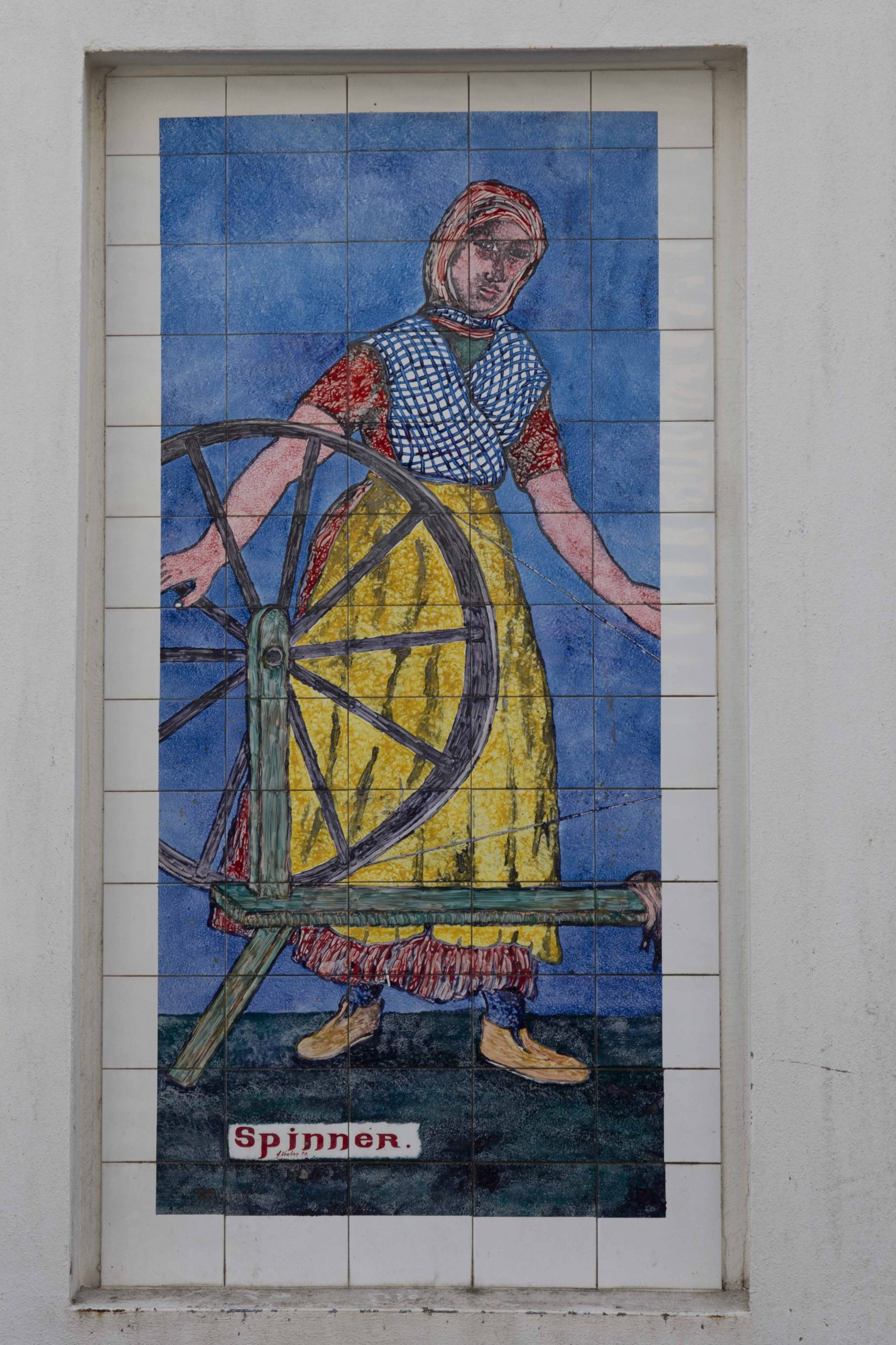
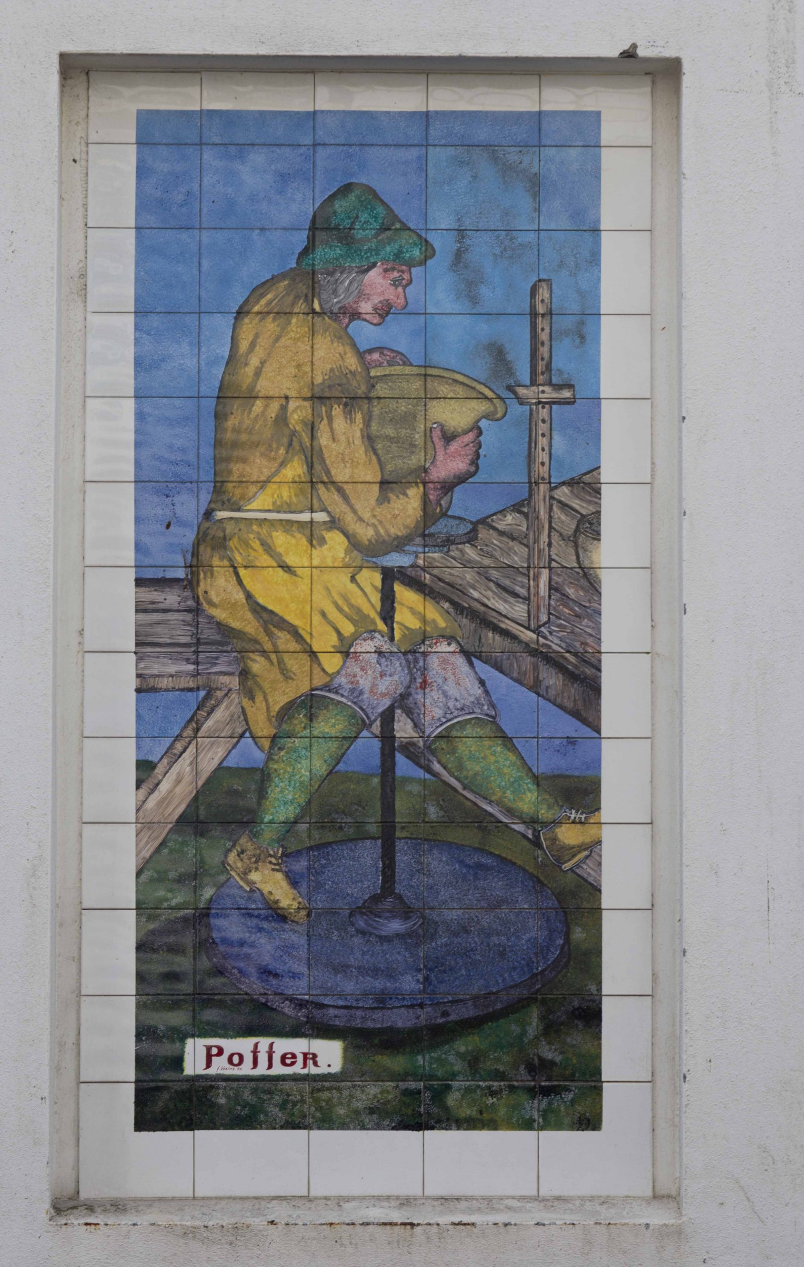
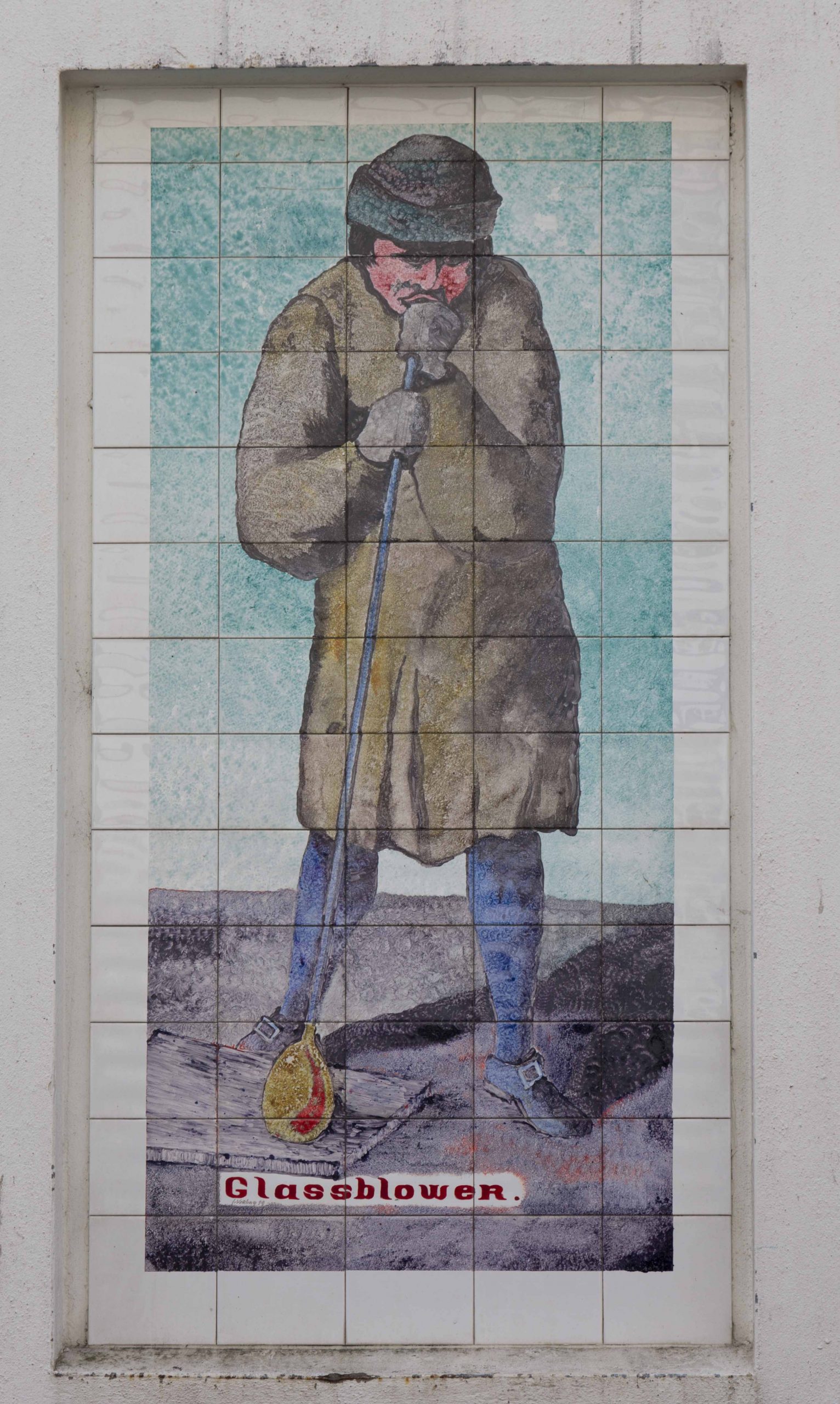
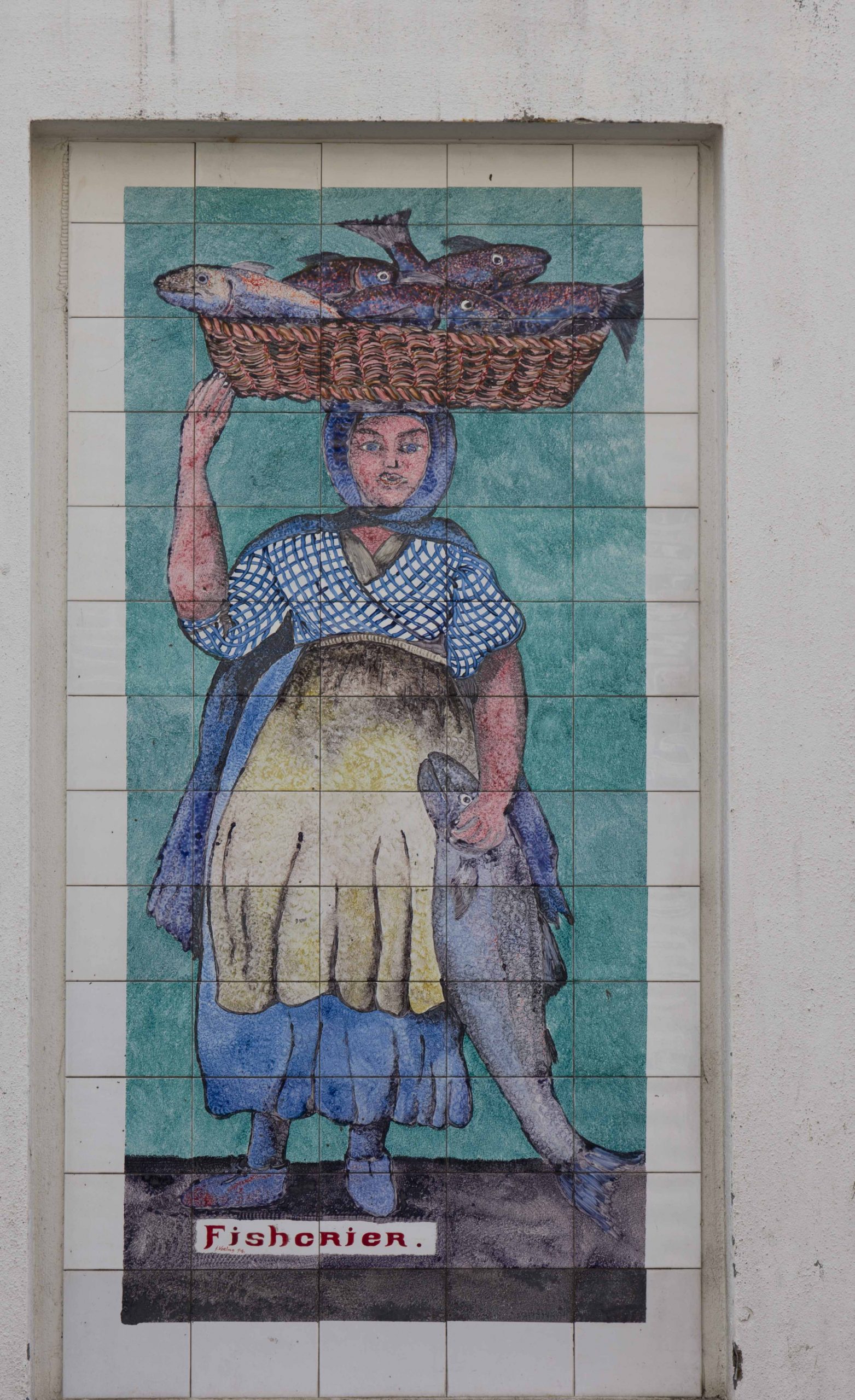
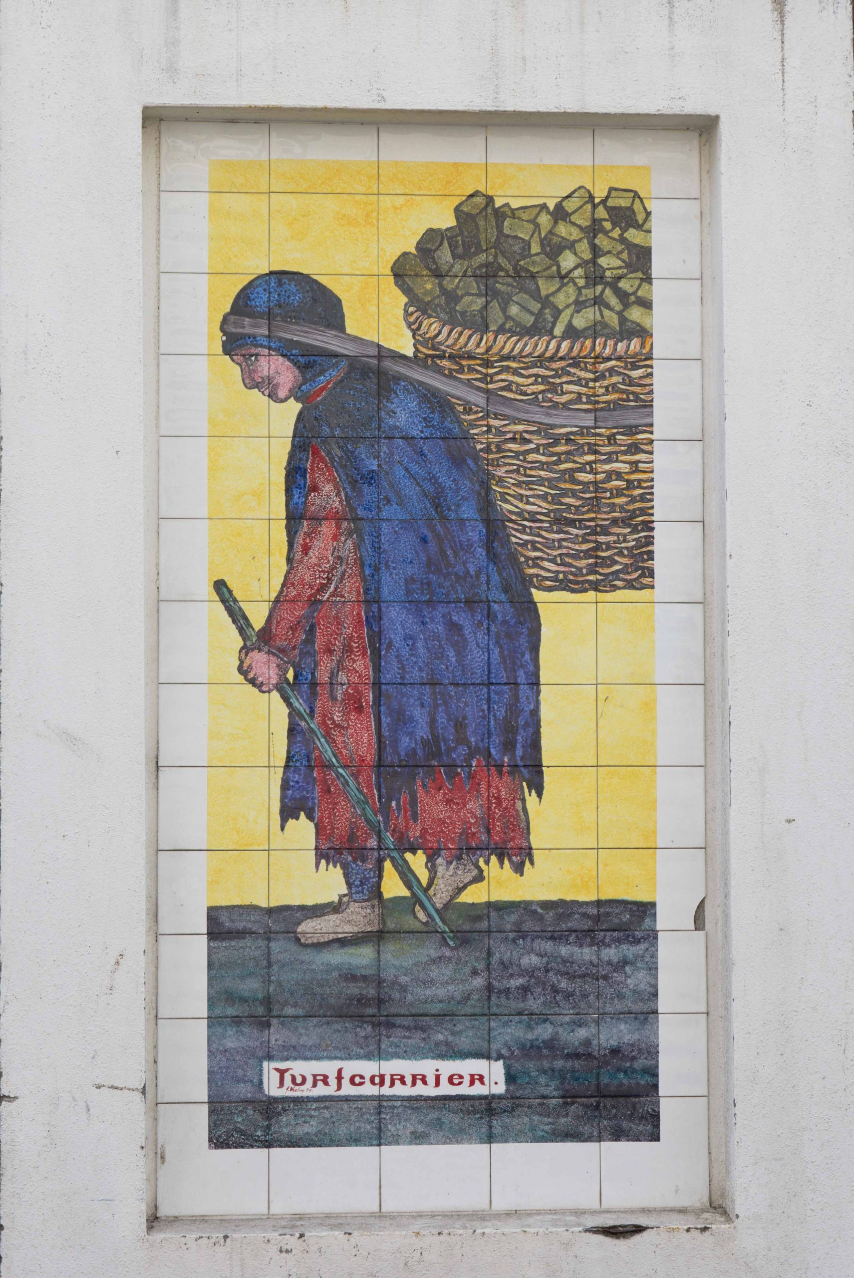
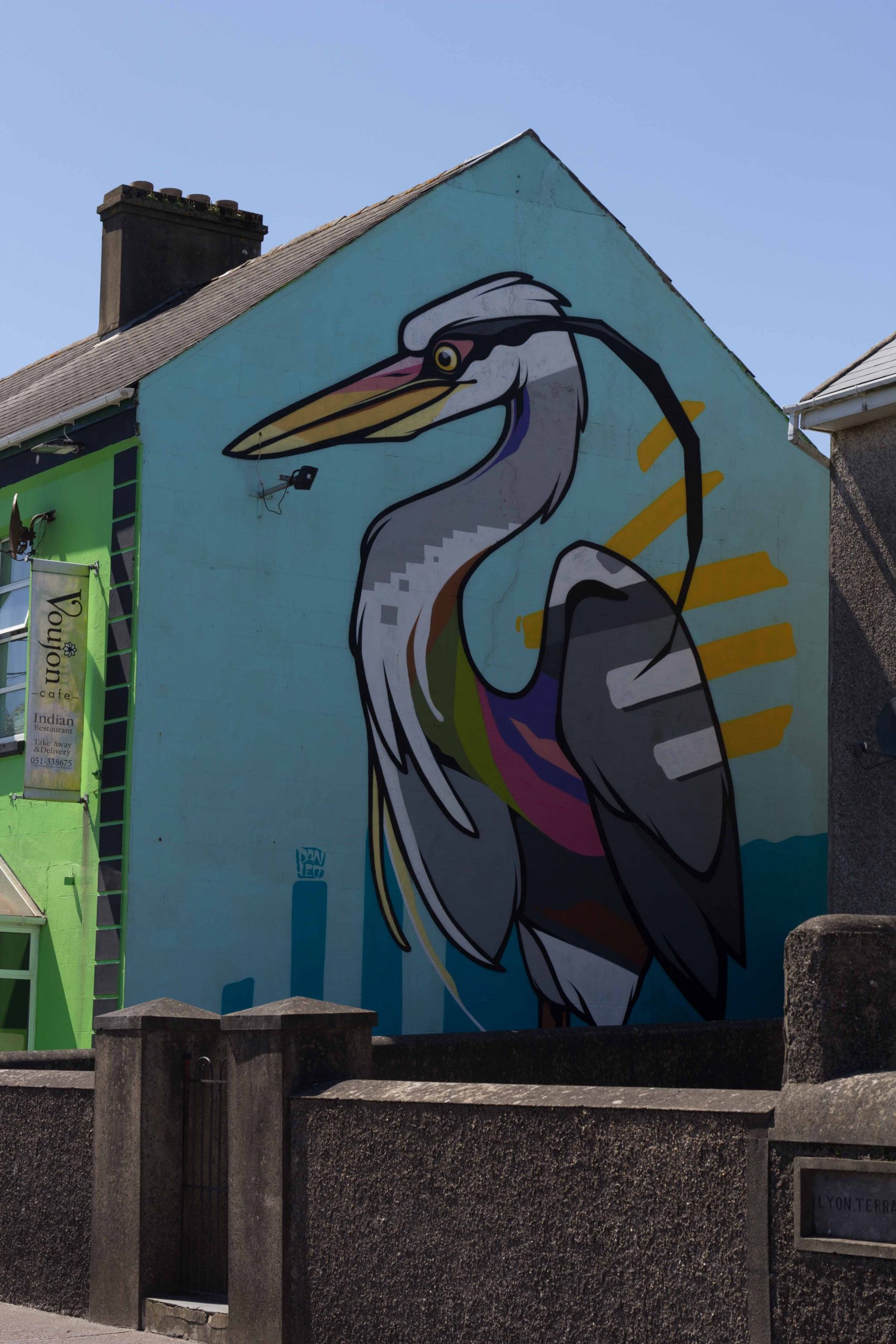
The city of Waterford, Ireland is known for its artistic tradition involving making glassware. Less known is the recent trend to decorate walls with artistic visions. In one street, murals reflect traditional jobs. Waterford attempts to combine the respect for the old with modern street art. It definitely adds a splash of color to your walk through town. Additionally, the murals demonstrate “what we have lost”, as arts and crafts have vanished in favor of mass-produced industrial items. But they may be on their way back, facilitated by local initiatives to keep old techniques alive. And local artists leave their mark on the modern city with large colorful depictions, for example of a heron.